Istanbul İstanbul | |||||||||||||||||||
|---|---|---|---|---|---|---|---|---|---|---|---|---|---|---|---|---|---|---|---|
Megacity | |||||||||||||||||||
| <templatestyles src="Multiple image/styles.css" wrapper=".tmulti"></templatestyles> Clockwise from top: the Golden Horn between Karaköy and Sarayburnu within the historic areas; Maiden's Tower; a nostalgic tram on İstiklal Avenue; Levent business district; Galata Tower; Ortaköy Mosque in front of the Bosphorus Bridge; and Hagia Sophia. | |||||||||||||||||||
<templatestyles src="Module:Location map/styles.css"></templatestyles> Turkey, with Istanbul pinpointed at the northwest along a thin strip of land bounded by water Istanbul Location within Turkey 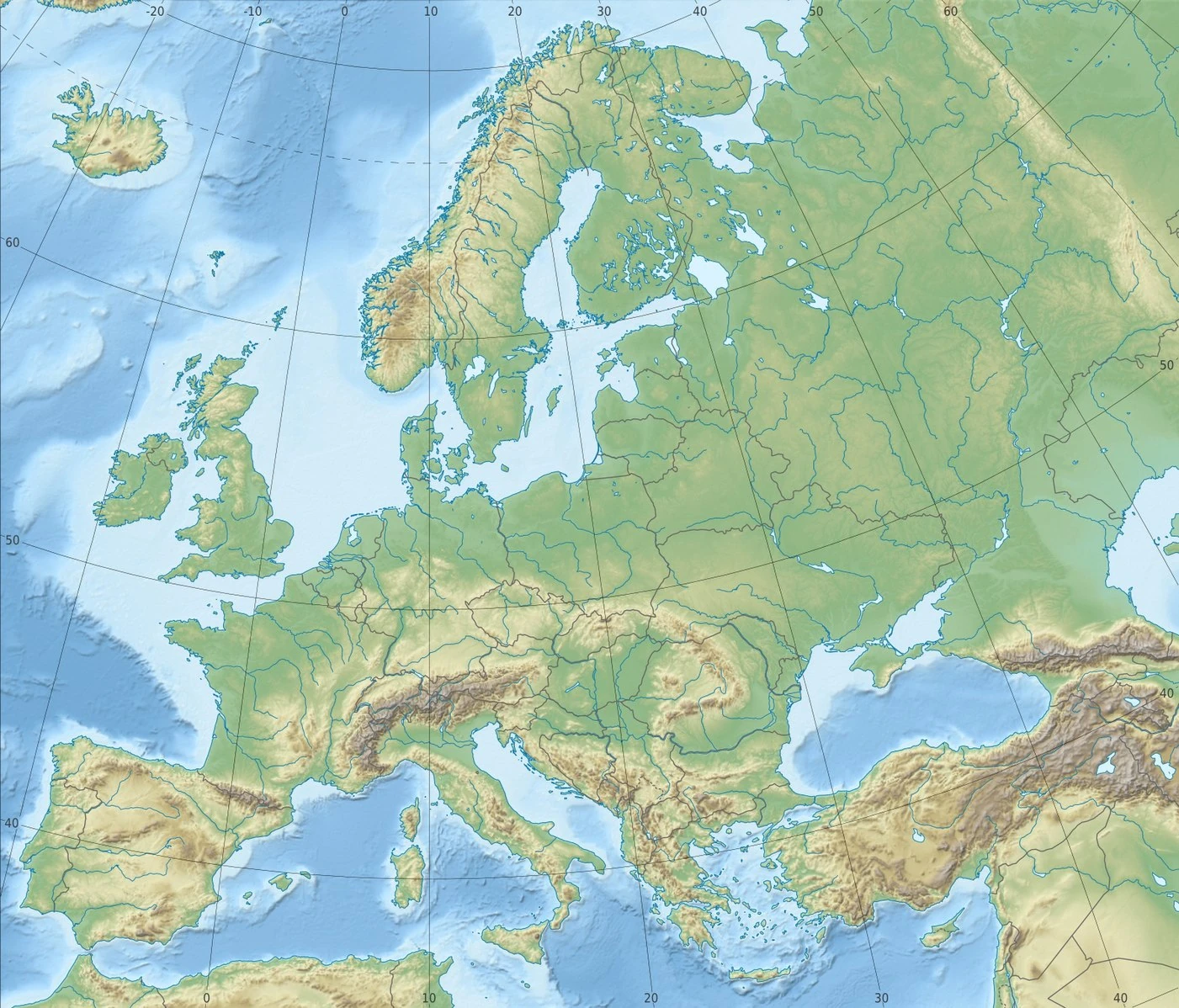 Istanbul Location within Europe Turkey, with Istanbul pinpointed at the northwest along a thin strip of land bounded by water Istanbul Location within Asia  Istanbul Istanbul (Earth) | |||||||||||||||||||
| Coordinates: 41°00′49″N 28°57′18″E / 41.01361°N 28.95500°ECoordinates: 41°00′49″N 28°57′18″E / 41.01361°N 28.95500°E Fatal error: The format of the coordinate could not be determined. Parsing failed. | |||||||||||||||||||
| Country | Turkey | ||||||||||||||||||
| Region | Marmara | ||||||||||||||||||
| Province | Istanbul | ||||||||||||||||||
| Provincial seat[lower-alpha 1] | Cağaloğlu, Fatih | ||||||||||||||||||
| Districts | 39 | ||||||||||||||||||
| Government | |||||||||||||||||||
| • Type | Mayor–council government | ||||||||||||||||||
| • Body | Municipal Council of Istanbul | ||||||||||||||||||
| • Mayor | Ekrem İmamoğlu (CHP) | ||||||||||||||||||
| • Governor | Ali Yerlikaya | ||||||||||||||||||
| Area | |||||||||||||||||||
| • Urban | 2,576.85 km2 (994.93 sq mi) | ||||||||||||||||||
| • Metro | 5,343.22 km2 (2,063.03 sq mi) | ||||||||||||||||||
| Highest elevation | 537 m (1,762 ft) | ||||||||||||||||||
| Population (31 December 2019)[4] | |||||||||||||||||||
| • Megacity | 15,519,267 | ||||||||||||||||||
| • Rank | 1st in Turkey | ||||||||||||||||||
| • Urban | 15,214,177 | ||||||||||||||||||
| • Urban density | 5,904/km2 (15,290/sq mi) | ||||||||||||||||||
| • Metro density | 2,904/km2 (7,520/sq mi) | ||||||||||||||||||
| Demonym(s) | Istanbulite (Turkish: İstanbullu) | ||||||||||||||||||
| Time zone | UTC+3 (TRT) | ||||||||||||||||||
| Postal code | 34000 to 34990 | ||||||||||||||||||
| Area code(s) | +90 212 (European side) +90 216 (Asian side) | ||||||||||||||||||
| Vehicle registration | 34 | ||||||||||||||||||
| GDP (PPP) | 2018[5] | ||||||||||||||||||
| - Total | US$ 537,507 billion | ||||||||||||||||||
| - Per capita | US$ 35,779 | ||||||||||||||||||
| HDI (2018) | 0.828[6] (very high) · 3rd | ||||||||||||||||||
| GeoTLD | .ist, .istanbul | ||||||||||||||||||
| Website | ibb www | ||||||||||||||||||
| |||||||||||||||||||
.jpg)
.JPG)
.jpg)
Istanbul (/ˌɪstænˈbʊl/ ist-AN-buul,[7][8] /[unsupported input]ˈɪstænbʊl/ ist-AN-buul; Turkish: İstanbul [isˈtanbuɫ] (Audio file "Istanbul pronunciation.ogg " not found)), formerly Byzantium and Constantinople, is the largest city in Turkey and the country's economic, cultural and historic center. The city straddles the Bosporus strait, and lies in both Europe and Asia, with a population of over 15 million residents.[4] Istanbul is the most populous city in Europe,[lower-alpha 2] and the world's fifteenth-largest city.
Founded as Byzantion by Megarian colonists in 660 BCE, and renamed as Constantinople in 330 CE,[9] the city grew in size and influence, becoming a beacon of the Silk Road and one of the most important cities in history. It served as an imperial capital for almost sixteen centuries, during the Roman/Byzantine (330–1204), Latin (1204–1261), Byzantine (1261–1453), and Ottoman (1453–1922) empires.[10] It was instrumental in the advancement of Christianity during Roman and Byzantine times, before its transformation to an Islamic stronghold following the Fall of Constantinople in 1453 CE.[11] In 1923, after the Turkish War of Independence, Ankara replaced the city as the capital of the newly formed Republic of Turkey. In 1930 the city's name was officially changed to Istanbul, an appellation Greek speakers used since the eleventh century to colloquially refer to the city.[12]
Over 13.4 million foreign visitors came to Istanbul in 2018, eight years after it was named a European Capital of Culture, making the city the world's fifth-most popular tourist destination.[13] Istanbul is home to several UNESCO World Heritage Sites, and hosts the headquarters of numerous Turkish companies, accounting for more than thirty percent of the country's economy.[14][15]
Toponymy[]
The first known name of the city is Byzantium (Greek: Βυζάντιον, Byzántion), the name given to it at its foundation by Megarean colonists around 660 BCE.[16] Megaran colonists claimed a direct line back to the founders of the city, Byzas, the son of the god Poseidon and the nymph Ceroëssa.[16] Modern excavations has raised the possibility that the name Byzantium might reflect the sites of native Thracian settlements that preceded the fully fledged town.[17] Constantinople comes from the Latin name Constantinus, after Constantine the Great, the Roman emperor who refounded the city in 324 CE.[16] Constantinople remained the most common name for the city in the West until Turkish Postal Service Law of 28 March 1930 insisted that mail be addressed to Istanbul.[18][19] Kostantiniyye (Template:Lang-ota), Be Makam-e Qonstantiniyyah al-Mahmiyyah (meaning "the Protected Location of Constantinople") and İstanbul were the names used alternatively by the Ottomans during their rule.[20]
The name İstanbul (Turkish pronunciation: [isˈtanbuɫ] (Audio file "Istanbul pronunciation.ogg " not found), colloquially [ɯsˈtambuɫ]) is commonly held to derive from the Medieval Greek phrase "εἰς τὴν Πόλιν" (pronounced [is tim ˈbolin]), which means "to the city"[21] and is how Constantinople was referred to by the local Greeks. This reflected its status as the only major city in the vicinity. The importance of Constantinople in the Ottoman world was also reflected by its Ottoman name "Der Saadet" meaning the "gate to Prosperity" in Ottoman. An alternative view is that the name evolved directly from the name Constantinople, with the first and third syllables dropped.[16] Some Ottoman sources of the 17th century, such as Evliya Çelebi, describe it as the common Turkish name of the time; between the late 17th and late 18th centuries, it was also in official use. The first use of the word "Islambol" on coinage was in 1703 (1115 AH) during the reign of Sultan Ahmed III.[22] In modern Turkish, the name is written as İstanbul, with a dotted İ, as the Turkish alphabet distinguishes between a dotted and dotless I. In English the stress is on the first or last syllable, but in Turkish it is on the second syllable (tan).[23] A person from the city is an İstanbullu (plural: İstanbullular), although Istanbulite is used in English.[24]
History[]
This huge keystone found in Çemberlitaş, Fatih, might have belonged to a triumphal arch at the Forum of Constantine; the forum was built by Constantine I in the quarter of modern-day Çemberlitaş.
Neolithic artifacts, uncovered by archeologists at the beginning of the 21st century, indicate that Istanbul's historic peninsula was settled as far back as the 6th millennium BCE.[25] That early settlement, important in the spread of the Neolithic Revolution from the Near East to Europe, lasted for almost a millennium before being inundated by rising water levels.[26][27][28][29] The first human settlement on the Asian side, the Fikirtepe mound, is from the Copper Age period, with artifacts dating from 5500 to 3500 BCE,[30] On the European side, near the point of the peninsula (Sarayburnu), there was a Thracian settlement during the early 1st millennium BCE. Modern authors have linked it to the Thracian toponym Lygos,[31] mentioned by Pliny the Elder as an earlier name for the site of Byzantium.[32]
The history of the city proper begins around 660 BCE,[33][lower-alpha 3] when Greek settlers from Megara established Byzantium on the European side of the Bosphorus. The settlers built an acropolis adjacent to the Golden Horn on the site of the early Thracian settlements, fueling the nascent city's economy.[39] The city experienced a brief period of Persian rule at the turn of the 5th century BCE, but the Greeks recaptured it during the Greco-Persian Wars.[40] Byzantium then continued as part of the Athenian League and its successor, the Second Athenian League, before gaining independence in 355 BCE.[41] Long allied with the Romans, Byzantium officially became a part of the Roman Empire in 73 CE.[42] Byzantium's decision to side with the Roman usurper Pescennius Niger against Emperor Septimius Severus cost it dearly; by the time it surrendered at the end of 195 CE, two years of siege had left the city devastated.[43] Five years later, Severus began to rebuild Byzantium, and the city regained—and, by some accounts, surpassed—its previous prosperity.[44]
Rise and fall of Constantinople and the Byzantine Empire[]
.jpg)
Originally a church, later a mosque, the 6th-century Hagia Sophia (532–537) by Byzantine emperor Justinian the Great was the largest cathedral in the world for nearly a thousand years, until the completion of the Seville Cathedral (1507) in Spain.
_by_Florentine_cartographer_Cristoforo_Buondelmonte.jpg)
Created in 1422 by Cristoforo Buondelmonti, this is the oldest surviving map of Constantinople.
Constantine the Great effectively became the emperor of the whole of the Roman Empire in September 324.[45] Two months later, he laid out the plans for a new, Christian city to replace Byzantium. As the eastern capital of the empire, the city was named Nova Roma; most called it Constantinople, a name that persisted into the 20th century.[46] On 11 May 330, Constantinople was proclaimed the capital of the Roman Empire, which was later permanently divided between the two sons of Theodosius I upon his death on 17 January 395, when the city became the capital of the Eastern Roman (Byzantine) Empire.[47]
The establishment of Constantinople was one of Constantine's most lasting accomplishments, shifting Roman power eastward as the city became a center of Greek culture and Christianity.[47][48] Numerous churches were built across the city, including Hagia Sophia which was built during the reign of Justinian the Great and remained the world's largest cathedral for a thousand years.[49] Constantine also undertook a major renovation and expansion of the Hippodrome of Constantinople; accommodating tens of thousands of spectators, the hippodrome became central to civic life and, in the 5th and 6th centuries, the center of episodes of unrest, including the Nika riots.[50][51] Constantinople's location also ensured its existence would stand the test of time; for many centuries, its walls and seafront protected Europe against invaders from the east and the advance of Islam.[48] During most of the Middle Ages, the latter part of the Byzantine era, Constantinople was the largest and wealthiest city on the European continent and at times the largest in the world.[52][53]
Constantinople began to decline continuously after the end of the reign of Basil II in 1025. The Fourth Crusade was diverted from its purpose in 1204, and the city was sacked and pillaged by the crusaders.[54] They established the Latin Empire in place of the Orthodox Byzantine Empire.[55] Hagia Sophia was converted to a Catholic church in 1204. The Byzantine Empire was restored, albeit weakened, in 1261.[56] Constantinople's churches, defenses, and basic services were in disrepair,[57] and its population had dwindled to a hundred thousand from half a million during the 8th century.[lower-alpha 4] After the reconquest of 1261, however, some of the city's monuments were restored, and some, like the two Deisis mosaics in Hagia Sofia and Kariye, were created.[citation needed]
Various economic and military policies instituted by Andronikos II, such as the reduction of military forces, weakened the empire and left it vulnerable to attack.[58] In the mid-14th-century, the Ottoman Turks began a strategy of gradually taking smaller towns and cities, cutting off Constantinople's supply routes and strangling it slowly.[59] On 29 May 1453, after an eight-week siege (during which the last Roman emperor, Constantine XI, was killed), Sultan Mehmed II "the Conqueror" captured Constantinople and declared it the new capital of the Ottoman Empire. Hours later, the sultan rode to the Hagia Sophia and summoned an imam to proclaim the Islamic creed, converting the grand cathedral into an imperial mosque due to the city's refusal to surrender peacefully.[60] Mehmed declared himself as the new "Kaysar-i Rûm" (the Ottoman Turkish equivalent of Caesar of Rome) and the Ottoman state was reorganized into an empire.[61]
Ottoman Empire and Turkish Republic eras[]
Following the conquest of Constantinople,[lower-alpha 5] Mehmed II immediately set out to revitalize the city. Cognizant that revitalization would fail without the repopulation of the city, Mehmed II welcomed everyone–foreigners, criminals, and runaways– showing extraordinary openness and willingness to incorporate outsiders that came to define Ottoman political culture.[63] He also invited people from all over Europe to his capital, creating a cosmopolitan society that persisted through much of the Ottoman period.[64] Revitalizing Istanbul also required a massive program of restorations, of everything from roads to aqueducts.[65] Like many monarchs before and since, Mehmed II transformed Istanbul's urban landscape with wholesale redevelopment of the city center.[66] There was a huge new palace to rival, if not overshadow, the old one, a new covered market (still standing as the Grand Bazaar), porticoes, pavilions, walkways, as well as more than a dozen new mosques.[65] Mehmed II turned the ramshackle old town into something that looked like an imperial capital.[66]
Maiden's Tower and the Seraglio Point
Social hierarchy was ignored by the rampant plague, which killed the rich and the poor alike in the sixteenth century.[67] Money could not protect the rich from all the discomforts and harsher sides of Istanbul.[67] Although the Sultan lived at a safe remove from the masses, and the wealthy and poor tended to live side by side, for the most part Istanbul was not zoned as modern cities are.[67] Opulent houses shared the same streets and districts with tiny hovels.[67] Those rich enough to have secluded country properties had a chance of escaping the periodic epidemics of sickness that blighted Istanbul.[67]
_and_view_of_Pera,_Constantinople,_Turkey,_ca._1895.jpg)
The first Galata Bridge in the 19th century
The Ottoman Dynasty claimed the status of caliphate in 1517, with Constantinople remaining the capital of this last caliphate for four centuries.[11] Suleiman the Magnificent's reign from 1520 to 1566 was a period of especially great artistic and architectural achievement; chief architect Mimar Sinan designed several iconic buildings in the city, while Ottoman arts of ceramics, stained glass, calligraphy, and miniature flourished.[68] The population of Constantinople was 570,000 by the end of the 18th century.[69]
A period of rebellion at the start of the 19th century led to the rise of the progressive Sultan Mahmud II and eventually to the Tanzimat period, which produced political reforms and allowed new technology to be introduced to the city.[70] Bridges across the Golden Horn were constructed during this period,[71] and Constantinople was connected to the rest of the European railway network in the 1880s.[72] Modern facilities, such as a water supply network, electricity, telephones, and trams, were gradually introduced to Constantinople over the following decades, although later than to other European cities.[73] The modernization efforts were not enough to forestall the decline of the Ottoman Empire.[citation needed]
<templatestyles src="Multiple image/styles.css" wrapper=".tmulti"></templatestyles>
Sultan Abdul Hamid II was deposed with the Young Turk Revolution in 1908 and the Ottoman Parliament, closed since 14 February 1878, was reopened 30 years later on 23 July 1908, which marked the beginning of the Second Constitutional Era.[74] A series of wars in the early 20th century, such as the Italo-Turkish War (1911–1912) and the Balkan Wars (1912–1913), plagued the ailing empire's capital and resulted in the 1913 Ottoman coup d'état, which brought the regime of the Three Pashas.[75]
The Ottoman Empire joined World War I (1914–1918) on the side of the Central Powers and was ultimately defeated. The deportation of Armenian intellectuals on 24 April 1915 was among the major events which marked the start of the Armenian Genocide during WWI.[76] Due to Ottoman and Turkish policies of Turkification and ethnic cleansing, the city's Christian population declined from 450,000 to 240,000 between 1914 and 1927.[77] The Armistice of Mudros was signed on 30 October 1918 and the Allies occupied Constantinople on 13 November 1918. The Ottoman Parliament was dissolved by the Allies on 11 April 1920 and the Ottoman delegation led by Damat Ferid Pasha was forced to sign the Treaty of Sèvres on 10 August 1920.[citation needed]
A view of Bankalar Caddesi (Banks Street) in the late 1920s. Completed in 1892, the Ottoman Central Bank headquarters is seen at left. In 1995 the Istanbul Stock Exchange moved to İstinye, while numerous Turkish banks have moved to Levent and Maslak.[citation needed]
Following the Turkish War of Independence (1919–1922), the Grand National Assembly of Turkey in Ankara abolished the Sultanate on 1 November 1922, and the last Ottoman Sultan, Mehmed VI, was declared persona non grata. Leaving aboard the British warship HMS Malaya on 17 November 1922, he went into exile and died in Sanremo, Italy, on 16 May 1926. The Treaty of Lausanne was signed on 24 July 1923, and the occupation of Constantinople ended with the departure of the last forces of the Allies from the city on 4 October 1923.[78] Turkish forces of the Ankara government, commanded by Şükrü Naili Pasha (3rd Corps), entered the city with a ceremony on 6 October 1923, which has been marked as the Liberation Day of Istanbul (Turkish: İstanbul'un Kurtuluşu) and is commemorated every year on its anniversary.[78] On 29 October 1923 the Grand National Assembly of Turkey declared the establishment of the Turkish Republic, with Ankara as its capital. Mustafa Kemal Atatürk became the Republic's first President.[79][80] According to historian Philip Mansel:
- after the departure of the dynasty in 1925, from being the most international city in Europe, Constantinople became one of the most nationalistic....Unlike Vienna, Constantinople turned its back on the past. Even its name was changed. Constantinople was dropped because of its Ottoman and international associations. From 1926 the post office only accepted Istanbul; it appeared more Turkish and was used by most Turks.[81][page needed]
A 1942 wealth tax assessed mainly on non-Muslims led to the transfer or liquidation of many businesses owned by religious minorities.[82] From the late 1940s and early 1950s, Istanbul underwent great structural change, as new public squares, boulevards, and avenues were constructed throughout the city, sometimes at the expense of historical buildings.[83] The population of Istanbul began to rapidly increase in the 1970s, as people from Anatolia migrated to the city to find employment in the many new factories that were built on the outskirts of the sprawling metropolis. This sudden, sharp rise in the city's population caused a large demand for housing, and many previously outlying villages and forests became engulfed into the metropolitan area of Istanbul.[84]
Geography[]
Satellite view of Istanbul and the strait of Bosporus
Istanbul is located in north-western Turkey and straddles the strait Bosporus, which provides the only passage from the Black Sea to the Mediterranean via the Sea of Marmara.[14] Historically, the city has been ideally situated for trade and defense: The confluence of the Sea of Marmara, the Bosphorus, and the Golden Horn provide both ideal defense against enemy attack and a natural toll-gate.[14] Several picturesque islands—Büyükada, Heybeliada, Burgazada, Kınalıada, and five smaller islands—are part of the city.[14] Istanbul's shoreline has grown beyond its natural limits. Large sections of Caddebostan sit on areas of landfill, increasing the total area of the city to 5,343 square kilometers (2,063 sq mi).[14]
Despite the myth that seven hills make up the city, there are in fact more than 50 hills within the city limits. Istanbul's tallest hill, Aydos, is 537 metres (1,762 ft) high.[14]
The nearby North Anatolian Fault is responsible for much earthquake activity, although it doesn't physically pass through the city itself.[85] North Anatolian Fault caused the earthquakes in 1766 and 1894.[85] The threat of major earthquakes plays a large role in the city's infrastructure development, with over 500,000[85] vulnerable buildings demolished and replaced since 2012.[86] The city has repeatedly upgraded its building codes, most recently in 2018,[86] requiring retrofits for older buildings and higher engineering standards for new construction.
Climate[]
Microclimates of Istanbul according to Köppen–Geiger classification system
Istanbul has borderline Mediterranean climate (Köppen Csa), humid subtropical climate (Köppen Cfa) and oceanic climate (Köppen Cfb) with generally cool winters and warm to hot summers (mean temperature peaking at 21.5 °C (70.7 °F) in August).[87] Spring and fall are usually mild, with varying conditions dependent on wind direction.[88][89]
Istanbul's weather is strongly influenced by the Sea of Marmara to the south, and the Black Sea to the north. This moderates temperature swings and produces a mild year-round climate with little seasonal temperature variation. Because of its hilly topography and maritime influences, Istanbul exhibits a multitude of distinct microclimates.[90] Within the city, rainfall varies widely owing to the rain shadow of the hills in Istanbul, from around 635 millimeters (25.0 in) on the southern fringe at Florya to 1,167 millimeters (45.9 in) on the northern fringe at Bahçeköy.[91]
Lake-effect snow is common and forms when cold air, upon contact with the Black Sea, develops into moist and unstable air that ascends to form snow squalls along the lee shores of the Black Sea.[92] These snow squalls are heavy snow bands and occasionally thundersnows, with accumulation rates approaching 5–8 centimeters (2.0–3.1 in) per hour.[93]
The highest recorded temperature at the official downtown observation station in Sarıyer was 41.5 °C (107 °F) and on 13 July 2000.[92] The lowest recorded temperature was −16.1 °C (3 °F) on 9 February 1929.[92] The highest recorded snow cover in the city center was 80 centimeters (31 in) on 4 January 1942, and 104 centimeters (41 in) in the northern suburbs on 11 January 2017.[94][92][95]
| Climate data for Istanbul (Sarıyer), 1981–2010 | |||||||||||||
|---|---|---|---|---|---|---|---|---|---|---|---|---|---|
| Month | Jan | Feb | Mar | Apr | May | Jun | Jul | Aug | Sep | Oct | Nov | Dec | Year |
| Record high °C (°F) | 22.4 (72.3) |
24.6 (76.3) |
29.3 (84.7) |
33.6 (92.5) |
36.4 (97.5) |
40.2 (104.4) |
41.5 (106.7) |
40.5 (104.9) |
39.6 (103.3) |
34.2 (93.6) |
27.8 (82.0) |
25.5 (77.9) |
41.5 (106.7) |
| Average high °C (°F) | 8.5 (47.3) |
8.7 (47.7) |
10.9 (51.6) |
15.5 (59.9) |
20.1 (68.2) |
25.0 (77.0) |
26.9 (80.4) |
27.2 (81.0) |
23.8 (74.8) |
19.2 (66.6) |
14.2 (57.6) |
10.4 (50.7) |
17.5 (63.5) |
| Daily mean °C (°F) | 5.8 (42.4) |
5.5 (41.9) |
7.3 (45.1) |
11.2 (52.2) |
15.7 (60.3) |
20.5 (68.9) |
22.9 (73.2) |
23.4 (74.1) |
19.9 (67.8) |
15.8 (60.4) |
11.0 (51.8) |
7.8 (46.0) |
13.9 (57.0) |
| Average low °C (°F) | 3.5 (38.3) |
2.9 (37.2) |
4.4 (39.9) |
7.8 (46.0) |
12.2 (54.0) |
16.7 (62.1) |
19.7 (67.5) |
20.4 (68.7) |
16.8 (62.2) |
13.2 (55.8) |
8.5 (47.3) |
5.5 (41.9) |
11.0 (51.8) |
| Record low °C (°F) | −13.9 (7.0) |
−16.1 (3.0) |
−11.1 (12.0) |
−2.0 (28.4) |
1.4 (34.5) |
7.1 (44.8) |
10.5 (50.9) |
10.2 (50.4) |
6.0 (42.8) |
0.6 (33.1) |
−7.2 (19.0) |
−11.5 (11.3) |
−16.1 (3.0) |
| Average precipitation mm (inches) | 99.5 (3.92) |
82.1 (3.23) |
69.2 (2.72) |
43.1 (1.70) |
31.5 (1.24) |
40.6 (1.60) |
39.6 (1.56) |
41.9 (1.65) |
64.4 (2.54) |
102.3 (4.03) |
110.3 (4.34) |
125.1 (4.93) |
849.6 (33.45) |
| Average precipitation days (≥ 0.1 mm) | 16.9 | 15.2 | 13.2 | 10.0 | 7.4 | 7.0 | 4.7 | 5.1 | 8.1 | 12.3 | 13.9 | 17.5 | 131.3 |
| Mean monthly sunshine hours | 68.2 | 89.6 | 142.6 | 180.0 | 248.0 | 297.6 | 319.3 | 288.3 | 234.0 | 158.1 | 93.0 | 62.0 | 2,180.7 |
| Mean daily sunshine hours | 2.2 | 3.2 | 4.6 | 6.0 | 8.0 | 9.6 | 10.3 | 9.3 | 7.8 | 5.1 | 3.1 | 2.0 | 5.9 |
| Source: Turkish State Meteorological Service[96] | |||||||||||||
| Climate data for Istanbul (Kireçburnu, Sarıyer), 1949–1999 | |||||||||||||
|---|---|---|---|---|---|---|---|---|---|---|---|---|---|
| Month | Jan | Feb | Mar | Apr | May | Jun | Jul | Aug | Sep | Oct | Nov | Dec | Year |
| Average high °C (°F) | 8.3 (46.9) |
8.7 (47.7) |
10.3 (50.5) |
15.2 (59.4) |
19.6 (67.3) |
24.2 (75.6) |
26.0 (78.8) |
26.1 (79.0) |
23.3 (73.9) |
19.0 (66.2) |
14.8 (58.6) |
10.9 (51.6) |
17.2 (63.0) |
| Daily mean °C (°F) | 5.5 (41.9) |
5.5 (41.9) |
6.7 (44.1) |
10.9 (51.6) |
15.4 (59.7) |
20.1 (68.2) |
22.4 (72.3) |
22.6 (72.7) |
19.5 (67.1) |
15.5 (59.9) |
11.6 (52.9) |
8.1 (46.6) |
13.7 (56.6) |
| Average low °C (°F) | 3.0 (37.4) |
2.9 (37.2) |
4.0 (39.2) |
7.5 (45.5) |
11.9 (53.4) |
16.2 (61.2) |
19.1 (66.4) |
19.7 (67.5) |
16.6 (61.9) |
12.8 (55.0) |
8.9 (48.0) |
5.6 (42.1) |
10.7 (51.2) |
| Average precipitation mm (inches) | 103.6 (4.08) |
70.5 (2.78) |
71.0 (2.80) |
47.2 (1.86) |
45.8 (1.80) |
36.8 (1.45) |
35.6 (1.40) |
38.6 (1.52) |
51.9 (2.04) |
81.3 (3.20) |
100.8 (3.97) |
122.0 (4.80) |
805.1 (31.7) |
| Average snowy days (≥ 0.1 mm) | 3.6 | 4.9 | 2.8 | 0.0 | 0.0 | 0.0 | 0.0 | 0.0 | 0.0 | 0.0 | 0.3 | 1.5 | 13.1 |
| Source: Turkish State Meteorological Service[97] (1949–1999) | |||||||||||||
| Climate data for Istanbul (Bahçeköy, Sarıyer), 1949–1999 | |||||||||||||
|---|---|---|---|---|---|---|---|---|---|---|---|---|---|
| Month | Jan | Feb | Mar | Apr | May | Jun | Jul | Aug | Sep | Oct | Nov | Dec | Year |
| Average high °C (°F) | 8.0 (46.4) |
8.6 (47.5) |
10.5 (50.9) |
15.9 (60.6) |
20.6 (69.1) |
24.7 (76.5) |
26.3 (79.3) |
26.6 (79.9) |
23.7 (74.7) |
19.2 (66.6) |
14.7 (58.5) |
10.4 (50.7) |
17.4 (63.4) |
| Daily mean °C (°F) | 4.6 (40.3) |
4.7 (40.5) |
6.0 (42.8) |
10.5 (50.9) |
15.0 (59.0) |
19.3 (66.7) |
21.5 (70.7) |
21.6 (70.9) |
18.2 (64.8) |
14.1 (57.4) |
12.2 (54.0) |
6.8 (44.2) |
12.9 (55.2) |
| Average low °C (°F) | 1.7 (35.1) |
1.6 (34.9) |
2.8 (37.0) |
6.4 (43.5) |
10.7 (51.3) |
14.5 (58.1) |
17.0 (62.6) |
17.6 (63.7) |
14.2 (57.6) |
10.8 (51.4) |
6.9 (44.4) |
3.9 (39.0) |
9.0 (48.2) |
| Average precipitation mm (inches) | 152.1 (5.99) |
100.1 (3.94) |
105.2 (4.14) |
57.2 (2.25) |
45.8 (1.80) |
40.5 (1.59) |
37.4 (1.47) |
54.1 (2.13) |
67.3 (2.65) |
118.2 (4.65) |
135.1 (5.32) |
175.4 (6.91) |
1,088.4 (42.84) |
| Average snowy days (≥ 0.1 mm) | 4.6 | 5.2 | 3.9 | 0.1 | 0.0 | 0.0 | 0.0 | 0.0 | 0.0 | 0.0 | 0.5 | 3.0 | 17.3 |
| Source: Turkish State Meteorological Service[98] (1949–1999) | |||||||||||||
| Climate data for Istanbul | |||||||||||||
|---|---|---|---|---|---|---|---|---|---|---|---|---|---|
| Month | Jan | Feb | Mar | Apr | May | Jun | Jul | Aug | Sep | Oct | Nov | Dec | Year |
| Average sea temperature °C (°F) | 8.4 (47.1) |
7.7 (45.9) |
8.3 (46.9) |
10.2 (50.4) |
15.5 (59.9) |
21.3 (70.3) |
24.6 (76.3) |
24.9 (76.8) |
22.8 (73.0) |
18.4 (65.1) |
13.8 (56.8) |
10.5 (50.9) |
15.5 (60.0) |
| Mean daily daylight hours | 10.0 | 11.0 | 12.0 | 13.0 | 14.0 | 15.0 | 15.0 | 14.0 | 12.0 | 11.0 | 10.0 | 9.0 | 12.2 |
| Average ultraviolet index | 2 | 2 | 4 | 5 | 7 | 8 | 9 | 8 | 6 | 4 | 2 | 1 | 5 |
| Source: Weather Atlas [99] | |||||||||||||
Climate change[]
Climate change in Turkey may cause more urban heatwaves,[100] droughts,[101] storms,[102] and flooding.[103][104] Sea level rise is forecast to affect city infrastructure, for example Kadıkoy metro station is threatened with flooding.[105] Xeriscaping of green spaces has been suggested,[106] and Istanbul has a climate-change action plan.[107]
Cityscape[]
Çırağan Palace (1867) briefly served as the Ottoman Parliament building between 14 November 1909 and 19 January 1910, when it was damaged by fire. It was restored between 1987 and 1992 and was reopened as a five-star hotel in the Kempinski Hotels chain.
A view of Topkapı Palace from across the Golden Horn, with the Prince Islands in the background
The Fatih district, which was named after Sultan Mehmed the Conqueror (Turkish: Fatih Sultan Mehmed), corresponds to what was, until the Ottoman conquest in 1453, the whole of the city of Constantinople (today is the capital district and called the historic peninsula of Istanbul) on the southern shore of the Golden Horn, across the medieval Genoese citadel of Galata on the northern shore. The Genoese fortifications in Galata were largely demolished in the 19th century, leaving only the Galata Tower, to make way for the northward expansion of the city.[108] Galata (Karaköy) is today a quarter within the Beyoğlu (Pera) district, which forms Istanbul's commercial and entertainment center and includes İstiklal Avenue and Taksim Square.[109]
Dolmabahçe Palace, the seat of government during the late Ottoman period, is in the Beşiktaş district on the European shore of the Bosphorus strait, to the north of Beyoğlu. The Sublime Porte (Bâb-ı Âli), which became a metonym for the Ottoman government, was originally used to describe the Imperial Gate (Bâb-ı Hümâyun) at the outermost courtyard of the Topkapı Palace; but after the 18th century, the Sublime Porte (or simply Porte) began to refer to the gate of the Sadrazamlık (Prime Ministry) compound in the Cağaloğlu quarter near Topkapı Palace, where the offices of the Sadrazam (Grand Vizier) and other Viziers were, and where foreign diplomats were received. The former village of Ortaköy is within Beşiktaş and gives its name to the Ortaköy Mosque on the Bosphorus, near the Bosphorus Bridge. Lining both the European and Asian shores of the Bosphorus are the historic yalıs, luxurious chalet mansions built by Ottoman aristocrats and elites as summer homes.[110] Farther inland, outside the city's inner ring road, are Levent and Maslak, Istanbul's main business districts.[111]
Originally outside the city, yalı residences along the Bosphorus are now homes in some of Istanbul's elite neighborhoods.
During the Ottoman period, Üsküdar (then Scutari) and Kadıköy were outside the scope of the urban area, serving as tranquil outposts with seaside yalıs and gardens. But in the second half of the 20th century, the Asian side experienced major urban growth; the late development of this part of the city led to better infrastructure and tidier urban planning when compared with most other residential areas in the city.[112] Much of the Asian side of the Bosphorus functions as a suburb of the economic and commercial centers in European Istanbul, accounting for a third of the city's population but only a quarter of its employment.[112] As a result of Istanbul's exponential growth in the 20th century, a significant portion of the city is composed of gecekondus (literally "built overnight"), referring to illegally constructed squatter buildings.[113] At present, some gecekondu areas are being gradually demolished and replaced by modern mass-housing compounds.[114] Moreover, large scale gentrification and urban renewal projects have been taking place,[115] such as the one in Tarlabaşı;[116] some of these projects, like the one in Sulukule, have faced criticism.[117] The Turkish government also has ambitious plans for an expansion of the city west and northwards on the European side in conjunction with plans for a third airport; the new parts of the city will include four different settlements with specified urban functions, housing 1.5 million people.[118]
Istanbul does not have a primary urban park, but it has several green areas. Gülhane Park and Yıldız Park were originally included within the grounds of two of Istanbul's palaces—Topkapı Palace and Yıldız Palace—but they were repurposed as public parks in the early decades of the Turkish Republic.[119] Another park, Fethi Paşa Korusu, is on a hillside adjacent to the Bosphorus Bridge in Anatolia, opposite Yıldız Palace in Europe. Along the European side, and close to the Fatih Sultan Mehmet Bridge, is Emirgan Park, which was known as the Kyparades (Cypress Forest) during the Byzantine period. In the Ottoman period, it was first granted to Nişancı Feridun Ahmed Bey in the 16th century, before being granted by Sultan Murad IV to the Safavid Emir Gûne Han in the 17th century, hence the name Emirgan. The 47-hectare (120-acre) park was later owned by Khedive Ismail Pasha of Ottoman Egypt and Sudan in the 19th century. Emirgan Park is known for its diversity of plants and an annual tulip festival is held there since 2005.[120] The AKP government's decision to replace Taksim Gezi Park with a replica of the Ottoman era Taksim Military Barracks (which was transformed into the Taksim Stadium in 1921, before being demolished in 1940 for building Gezi Park) sparked a series of nationwide protests in 2013 covering a wide range of issues. Popular during the summer among Istanbulites is Belgrad Forest, spreading across 5,500 hectares (14,000 acres) at the northern edge of the city. The forest originally supplied water to the city and remnants of reservoirs used during Byzantine and Ottoman times survive.[121][122]
Architecture[]
Interior facade of the Gate of the Sultan (Saltanat Kapısı) located on Dolmabahçe Avenue, one of the main entrances of Dolmabahçe Palace.
<templatestyles src="Multiple image/styles.css" wrapper=".tmulti"></templatestyles>
Istanbul is primarily known for its Byzantine and Ottoman architecture, and despite its development as a Turkish city since 1453, contains both Christian and ancient monuments.
There are three ancient monuments in the city.[124] The most ancient is the Egyptian Obelisk.[124] Built of red granite, 31 m (100 ft) high, it came from the Temple of Karnak at Luxor, erected in 1500 BC.[124] It was brought to Istanbul in 357 CE by the order of Constantius II and put up in the Hippodrome.[124] When re-erected, the Egyptian Obelisk was mounted on a decorative base, with a statue that depicted Theodosius I and his courtiers.[124] Next in age is the Serpentine Column, from 479 BCE.[124] It was brought from Delphi in the time of Augustus and also erected in the Hippodrome.[124] The slightly smaller Column of Constantine Porphyrogenitus, was another of Augustus's trophies. Built of porphyry, 35 m (115 ft) high, it came from Heliopolis, erected in 330 CE to inaugurate the new Byzantine capital.[124] Originally part of a sculpture of Emperor Constantine the Great dressed as Apollo, the column first stood at the entrance to the Forum of Constantine.[124]
There are traces of the Byzantine era throughout the city, from ancient churches that were built over early Christian meeting places like Chora Church, Hagia Irene to public places like the Hippodrome, the Augustaion. It is the Hagia Sophia, however, that fully conveys the period of Constantinople as a city without parallel in Christendom.
Hagia Sophia, topped by a dome 31 meters (102 ft) in diameter over a square space defined by four arches, is the pinnacle of the Byzantine architecture.[125] Hagia Sophia stood as the world's largest cathedral in the world until it was converted into a mosque in the 15th century.[125] The minarets date from that period.[125]
Over the next four centuries, the Ottomans transformed of Istanbul's urban landscape with a vast building scheme building towering mosques and ornate palaces. Blue Mosque, another landmark of the city, faces Haghia Sophia in Sultanahmet Square.
Completed in 1616, the Sultan Ahmed Mosque is popularly known as the Blue Mosque due to the blue İznik tiles which adorn its interior.[126]
Among the oldest surviving examples of Ottoman architecture in Istanbul are the Anadoluhisarı and Rumelihisarı fortresses, which assisted the Ottomans during their siege of the city.[127] Over the next four centuries, the Ottomans made an indelible impression on the skyline of Istanbul, building towering mosques and ornate palaces.
Topkapı Palace, dating back to 1465, is the oldest seat of government surviving in Istanbul. Mehmet II built the original palace as his main residence and the seat of government.[128] The present palace grew over the centuries as a series of additions enfolding four courtyards and blending neoclassical, rococo, and baroque architectural forms.[129] In 1639 Murat IV made some of the most lavish additions, including the Baghdad Kiosk, to commemorate his conquest of Baghdad the previous year.[130] Government meetings took place here until 1786, when the seat of government was moved to the Sublime Porte.[128] After several hundred years of royal residence, it was abandoned in 1853 in favor of the baroque Dolmabahçe Palace.[129] Topkapı Palace became public property following the abolition of monarchy in 1922.[129] After extensive renovation, it became one of Turkey's first national museums in 1924.[128]
The imperial mosques include Fatih Mosque, Bayezid Mosque, Yavuz Selim Mosque, Süleymaniye Mosque, Sultan Ahmed Mosque (the Blue Mosque), and Yeni Mosque, all of which were built at the peak of the Ottoman Empire, in the 16th and 17th centuries. In the following centuries, and especially after the Tanzimat reforms, Ottoman architecture was supplanted by European styles.[131] An example of which is the imperial Nuruosmaniye Mosque. Areas around İstiklal Avenue were filled with grand European embassies and rows of buildings in Neoclassical, Renaissance Revival and Art Nouveau styles, which went on to influence the architecture of a variety of structures in Beyoğlu—including churches, stores, and theaters—and official buildings such as Dolmabahçe Palace.[132]
Administration[]
Istanbul's districts extend far from the city center, along the full length of the Bosphorus (with the Black Sea at the top and the Sea of Marmara at the bottom of the map).
Since 2004, the municipal boundaries of Istanbul have been coincident with the boundaries of its province.[133] The city, considered capital of Istanbul Province, is administered by the Istanbul Metropolitan Municipality (MMI), which oversees the 39 districts of the city-province.
The current city structure can be traced back to the Tanzimat period of reform in the 19th century, before which Islamic judges and imams led the city under the auspices of the Grand Vizier. Following the model of French cities, this religious system was replaced by a mayor and a citywide council composed of representatives of the confessional groups (millet) across the city. Pera (now Beyoğlu) was the first area of the city to have its own director and council, with members instead being longtime residents of the neighborhood.[134] Laws enacted after the Ottoman constitution of 1876 aimed to expand this structure across the city, imitating the twenty arrondissements of Paris, but they were not fully implemented until 1908, when the city was declared a province with nine constituent districts.[135][136] This system continued beyond the founding of the Turkish Republic, with the province renamed a belediye (municipality), but the municipality was disbanded in 1957.[137]
Statue of Atatürk in Büyükada, the largest of the Prince Islands to the southeast of Istanbul, which collectively form the Adalar (Isles) district of Istanbul Province
Small settlements adjacent to major population centers in Turkey, including Istanbul, were merged into their respective primary cities during the early 1980s, resulting in metropolitan municipalities.[138][139] The main decision-making body of the Istanbul Metropolitan Municipality is the Municipal Council, with members drawn from district councils.
The Municipal Council is responsible for citywide issues, including managing the budget, maintaining civic infrastructure, and overseeing museums and major cultural centers.[140] Since the government operates under a "powerful mayor, weak council" approach, the council's leader—the metropolitan mayor—has the authority to make swift decisions, often at the expense of transparency.[141] The Municipal Council is advised by the Metropolitan Executive Committee, although the committee also has limited power to make decisions of its own.[142] All representatives on the committee are appointed by the metropolitan mayor and the council, with the mayor—or someone of his or her choosing—serving as head.[142][143]
A view of Taksim Square with the Republic Monument (1928) designed by Italian sculptor Pietro Canonica
District councils are chiefly responsible for waste management and construction projects within their respective districts. They each maintain their own budgets, although the metropolitan mayor reserves the right to review district decisions. One-fifth of all district council members, including the district mayors, also represent their districts in the Municipal Council.[140] All members of the district councils and the Municipal Council, including the metropolitan mayor, are elected to five-year terms.[144] Representing the Republican People's Party, Ekrem İmamoğlu has been the Mayor of Istanbul since 27 June 2019.[145]
With the Istanbul Metropolitan Municipality and Istanbul Province having equivalent jurisdictions, few responsibilities remain for the provincial government. Similar to the MMI, the Istanbul Special Provincial Administration has a governor, a democratically elected decision-making body—the Provincial Parliament—and an appointed Executive Committee. Mirroring the executive committee at the municipal level, the Provincial Executive Committee includes a secretary-general and leaders of departments that advise the Provincial Parliament.[143][146] The Provincial Administration's duties are largely limited to the building and maintenance of schools, residences, government buildings, and roads, and the promotion of arts, culture, and nature conservation.[147] Ali Yerlikaya has been the Governor of Istanbul Province since 26 October 2018.[148]
Demographics[]
|
| |||||||||||||||||||||||||||||||||||||||||||||||||||||||||||||||||||||||||||||||||||||||||||||||||||||||||||||
| Sources: Jan Lahmeyer 2004,Chandler 1987, Morris 2010,Turan 2010[149] Pre-Republic figures estimated[lower-alpha 4] | ||||||||||||||||||||||||||||||||||||||||||||||||||||||||||||||||||||||||||||||||||||||||||||||||||||||||||||||
Throughout most of its history, Istanbul has ranked among the largest cities in the world. By 500 CE, Constantinople had somewhere between 400,000 and 500,000 people, edging out its predecessor, Rome, for the world's largest city.[151] Constantinople jostled with other major historical cities, such as Baghdad, Chang'an, Kaifeng and Merv for the position of the world's largest city until the 12th century. It never returned to being the world's largest, but remained the largest city in Europe from 1500 to 1750, when it was surpassed by London.[152]
The Turkish Statistical Institute estimates that the population of Istanbul Metropolitan Municipality was 15,519,267 at the end of 2019, hosting 19 percent of the country's population.[153] 64.4% of the residents live on the European side and 35.6% on the Asian side.[153]
Istanbul ranks as the seventh-largest city proper in the world, and the second-largest urban agglomeration in Europe, after Moscow.[154][155] The city's annual population growth of 1.5 percent ranks as one of the highest among the seventy-eight largest metropolises in the Organisation for Economic Co-operation and Development. The high population growth mirrors an urbanization trend across the country, as the second and third fastest-growing OECD metropolises are the Turkish cities of Izmir and Ankara.[15]
Istanbul experienced especially rapid growth during the second half of the 20th century, with its population increasing tenfold between 1950 and 2000.[156] This growth was fueled by internal and international migration. Istanbul's foreign population with a residence permit increased dramatically, from 43,000 in 2007[157] to 856,377 in 2019.[158][159]
Religious and ethnic groups[]
The Blue Mosque
.jpg)
The Ahrida (Ohrid) Synagogue is one of the city's 34 active synagogues.[160]
Istanbul has been a cosmopolitan city throughout much of its history, but it has become more homogenized since the end of the Ottoman era. Muslims form roughly 86% of the population in the city.[161][162][163][164] Arabs form the city's largest ethnic minority, with an estimated population of more than 2 million.[165] Following Turkey's support for the Arab Spring, Istanbul emerged as a hub for dissidents from across the Arab world, including former presidential candidates from Egypt, Kuwaiti MPs, and former ministers from Jordan, Saudi Arabia (including Jamal Khashoggi), Syria, and Yemen.[166][167][168] With almost two million residents claiming full or partial Kurdish ancestry, Kurds form the second-largest ethnic minority in Istanbul. Although the Kurdish presence in the city dates back to the early Ottoman period,[169] the majority of Kurds in the city originate from villages in eastern and southeastern Turkey.[170]
There are 234 active churches in the city,[160] including the Church of St. Anthony on Istiklal Avenue.
Greeks and Armenians form the largest Christian population in the city. While Istanbul's Greek population was exempted from the 1923 population exchange with Greece, changes in tax status and the 1955 anti-Greek pogrom prompted thousands to leave.[171] Following Greek migration to the city for work in the 2010s, the Greek population rose to nearly 3,000 in 2019, still greatly diminished since 1919, when it stood at 350,000.[171] There are today 123,363 Armenians in Istanbul, down from a peak of 164,000 in 1913.[172]
The majority of the Levantines (Turkish: Levanten) in Istanbul and Izmir are the descendants of traders/colonists from the Italian maritime republics of the Mediterranean (especially Genoa and Venice) and France, who obtained special rights and privileges called the Capitulations from the Ottoman sultans in the 16th century.[173] The community had more than 15,000 members during Atatürk's presidency in the 1920s and 1930s, but today is reduced to only a few hundreds, according to Italo-Levantine writer Giovanni Scognamillo.[174] They continue to live in Istanbul (mostly in Karaköy, Beyoğlu and Nişantaşı), and Izmir (mostly in Karşıyaka, Bornova and Buca).
Istanbul became one of the world's most important Jewish centers in the 16th and 17th century.[175] Romaniote and Ashkenazi communities existed in Istanbul before the conquest of Istanbul, but it was the arrival of Sephardic Jews that ushered a period of cultural flourishing. Sephardic Jews settled in the city after their expulsion from Spain and Portugal in 1492 and 1497.[175] Sympathetic to the plight of Sephardic Jews, Bayezid II sent out the Ottoman Navy under the command of admiral Kemal Reis to Spain in 1492 in order to evacuate them safely to Ottoman lands.[175] In marked contrast to Jews in Europe, Ottoman Jews were allowed to work in any profession.[176] Ottoman Jews in Istanbul excelled in commerce, and came to particularly dominate the medical profession.[176] By 1711, using the printing press, books came to be published in Spanish and Ladino, Yiddish, and Hebrew.[177] In large part due to emigration to Israel, the Jewish population in the city dropped from 100,000 in 1950[178] to 25,000 in 2020.
Politics[]
Ekrem İmamoğlu of the CHP is the 32nd and current Mayor of Istanbul, elected in 2019.
Politically, Istanbul is seen as the most important administrative region in Turkey. Many politicians, including President Recep Tayyip Erdoğan, are of the view that a political party's performance in Istanbul is more significant than its general performance overall. This is due to the city's role as Turkey's financial center, its large electorate and the fact that Erdoğan himself was elected Mayor of Istanbul in 1994.[citation needed] In the run-up to local elections in 2019, Erdoğan claimed 'if we fail in Istanbul, we will fail in Turkey'.[179]
The contest in Istanbul carried deep political, economic and symbolic significance for Erdoğan, whose election of mayor of Istanbul in 1994 had served as his launchpad.[180] For Ekrem İmamoğlu, winning the mayorship of Istanbul was a huge moral victory, but for Erdoğan it had practical ramifications: His party, AKP, lost control of the $4.8 billion municipal budget, which had sustained patronage at the point of delivery of many public services for 25 years.[181]
More recently, Istanbul and many of Turkey's metropolitan cities are following a trend away from the government and their right-wing ideology. In 2013 and 2014, large-scale anti-AKP government protests began in İstanbul and spread throughout the nation. This trend first became evident electorally in the 2014 mayoral election where the center-left opposition candidate won an impressive 40% of the vote, despite not winning. The first government defeat in Istanbul occurred in the 2017 constitutional referendum, where Istanbul voted 'No' by 51.4% to 48.6%. The AKP government had supported a 'Yes' vote and won the vote nationally due to high support in rural parts of the country. The biggest defeat for the government came in the 2019 local elections, where their candidate for Mayor, former Prime Minister Binali Yıldırım, was defeated by a very narrow margin by the opposition candidate Ekrem İmamoğlu. İmamoğlu won the vote with 48.77% of the vote, against Yıldırım's 48.61%. Similar trends and electoral successes for the opposition were also replicated in Ankara, Izmir, Antalya, Mersin, Adana and other metropolitan areas of Turkey.[citation needed]
Administratively, Istanbul is divided into 39 districts, more than any other province in Turkey. As a province, Istanbul sends 98 Members of Parliament to the Grand National Assembly of Turkey, which has a total of 600 seats. For the purpose of parliamentary elections, Istanbul is divided into three electoral districts; two on the European side and one on the Asian side, electing 28, 35 and 35 MPs respectively.[citation needed]
Economy[]
A view of Levent[182][183] financial district from the observation deck of Istanbul Sapphire. Levent, Maslak, Şişli and Ataşehir are the main business districts in the city.
Istanbul had the eleventh-largest economy among the world's urban areas in 2018, and is responsible for 30 percent of Turkey's industrial output,[184] 31 percent of GDP,[184] and 47 percent of tax revenues.[184] The city's gross domestic product adjusted by PPP stood at US$537.507 billion in 2018,[5] with manufacturing and services accounting for 36 percent and 60 percent of the economic output respectively.[184] Istanbul's productivity is 110 percent higher than the national average.[184] Trade is economically important, accounting for 30 percent of the economic output in the city.[14] In 2019, companies based in Istanbul produced exports worth $83.66 billion and received imports totaling $128.34 billion; these figures were equivalent to 47 percent and 61 percent, respectively, of the national totals.[185]
Istanbul, which straddles the Bosporus strait, houses international ports that link Europe and Asia. The Bosporus, providing the only passage from the Black Sea to the Mediterranean, is the world's busiest and narrowest strait used for international navigation, with more than 200 million tons of oil passing through it each year.[186] International conventions guarantee passage between the Black and the Mediterranean seas,[187] even when tankers carry oil, LNG/LPG, chemicals, and other flammable or explosive materials as cargo. In 2011, as a workaround solution, the then Prime Minister Erdoğan presented Canal Istanbul, a project to open a new strait between the Black and Marmara seas.[187] While the project was still on Turkey's agenda in 2020, there has not been a clear date set for it.[14]
İstiklal Avenue is visited by nearly three million people on weekend days.
Shipping is a significant part of the city's economy, with 73.9 percent of exports and 92.7 percent of imports in 2018 executed by sea.[14] Istanbul has three major shipping ports – the Port of Haydarpaşa, the Port of Ambarlı, and the Port of Zeytinburnu – as well as several smaller ports and oil terminals along the Bosporus and the Sea of Marmara.[14] Haydarpaşa, at the southeastern end of the Bosporus, was Istanbul's largest port until the early 2000s.[188] Since then operations were shifted to Ambarlı, with plans to convert Haydarpaşa into a tourism complex.[14] In 2019, Ambarlı, on the western edge of the urban center, had an annual capacity of 3,104,882 TEUs, making it the third-largest cargo terminal in the Mediterranean basin.[188]
Istanbul has been an international banking hub since the 1980s,[14] and is home to the only stock exchange in Turkey. Borsa Istanbul was originally established as the Ottoman Stock Exchange in 1866.[189] In 1995, keeping up with the financial trends, Borsa Istanbul has moved its headquarters from Bankalar Caddesi – traditionally the financial center of the Ottoman Empire and Turkey,[189] – to the district of Maslak, which hosts the headquarters of the majority of Turkish banks.[190] By 2022Template:Update inline span,[191] Borsa Istanbul is scheduled to move to a new planned district in Ataşehir, which will host the headquarters of Turkish banks, including the Central Bank that is currently headquartered in Ankara.[192] Whereas 2.4 million foreigners visited the city in 2000,[citation needed] there were 13.4 million foreign tourists in 2018, making Istanbul the world's fifth most-visited city.[13] Istanbul is, after Antalya, Turkey's second-largest international gateway, receiving a quarter of the nation's foreign tourists. Istanbul has more than fifty museums, with Topkapı Palace, the most visited museum in the city, bringing in more than $30 million in revenue each year.[14]
Culture[]
_-_Mart_2013.JPG)
The Istanbul Archaeology Museums, founded by Osman Hamdi Bey in 1891, form Turkey's oldest modern museum.[193]
Pera Museum in Beyoğlu
Istanbul was historically known as a cultural hub, but its cultural scene stagnated after the Turkish Republic shifted its focus toward Ankara.[194] The new national government established programs that served to orient Turks toward musical traditions, especially those originating in Europe, but musical institutions and visits by foreign classical artists were primarily centered in the new capital.[195] Much of Turkey's cultural scene had its roots in Istanbul, and by the 1980s and 1990s Istanbul reemerged globally as a city whose cultural significance is not solely based on its past glory.[196]
By the end of the 19th century, Istanbul had established itself as a regional artistic center, with Turkish, European, and Middle Eastern artists flocking to the city. Despite efforts to make Ankara Turkey's cultural heart, Istanbul had the country's primary institution of art until the 1970s.[197] When additional universities and art journals were founded in Istanbul during the 1980s, artists formerly based in Ankara moved in.[198] Beyoğlu has been transformed into the artistic center of the city, with young artists and older Turkish artists formerly residing abroad finding footing there. Modern art museums, including İstanbul Modern, the Pera Museum, Sakıp Sabancı Museum and SantralIstanbul, opened in the 2000s to complement the exhibition spaces and auction houses that have already contributed to the cosmopolitan nature of the city.[199] These museums have yet to attain the popularity of older museums on the historic peninsula, including the Istanbul Archaeology Museums, which ushered in the era of modern museums in Turkey, and the Turkish and Islamic Arts Museum.[193]
The first film screening in Turkey was at Yıldız Palace in 1896, a year after the technology publicly debuted in Paris.[200] Movie theaters rapidly cropped up in Beyoğlu, with the greatest concentration of theaters being along the street now known as İstiklal Avenue.[201] Istanbul also became the heart of Turkey's nascent film industry, although Turkish films were not consistently developed until the 1950s.[202] Since then, Istanbul has been the most popular location to film Turkish dramas and comedies.[203] The Turkish film industry ramped up in the second half of the century, and with Uzak (2002) and My Father and My Son (2005), both filmed in Istanbul, the nation's movies began to see substantial international success.[204] Istanbul and its picturesque skyline have also served as a backdrop for several foreign films, including From Russia with Love (1963), Topkapi (1964), The World Is Not Enough (1999), and Mission Istaanbul (2008).[205]
Coinciding with this cultural reemergence was the establishment of the Istanbul Festival, which began showcasing a variety of art from Turkey and around the world in 1973. From this flagship festival came the International Istanbul Film Festival and the Istanbul International Jazz Festival in the early 1980s. With its focus now solely on music and dance, the Istanbul Festival has been known as the Istanbul International Music Festival since 1994.[206] The most prominent of the festivals that evolved from the original Istanbul Festival is the Istanbul Biennial, held every two years since 1987. Its early incarnations were aimed at showcasing Turkish visual art, and it has since opened to international artists and risen in prestige to join the elite biennales, alongside the Venice Biennale and the São Paulo Art Biennial.[207]
Leisure and entertainment[]
.JPG)
The Grand Bazaar is one of the largest covered markets in the world.
Istanbul has numerous shopping centers, from the historic to the modern. The Grand Bazaar, in operation since 1461, is among the world's oldest and largest covered markets.[208][209] Mahmutpasha Bazaar is an open-air market extending between the Grand Bazaar and the Egyptian Bazaar, which has been Istanbul's major spice market since 1660. Galleria Ataköy ushered in the age of modern shopping malls in Turkey when it opened in 1987.[210] Since then, malls have become major shopping centers outside the historic peninsula. Akmerkez was awarded the titles of "Europe's best" and "World's best" shopping mall by the International Council of Shopping Centers in 1995 and 1996; Istanbul Cevahir has been one of the continent's largest since opening in 2005; Kanyon won the Cityscape Architectural Review Award in the Commercial Built category in 2006.[209] İstinye Park in İstinye and Zorlu Center near Levent are among the newest malls which include the stores of the world's top fashion brands. Abdi İpekçi Street in Nişantaşı and Bağdat Avenue on the Anatolian side of the city have evolved into high-end shopping districts.[211][212]
Zorlu Center design by Emre Arolat Architects and Tabanlıoğlu Architects.
Istanbul is known for its historic seafood restaurants. Many of the city's most popular and upscale seafood restaurants line the shores of the Bosphorus (particularly in neighborhoods like Ortaköy, Bebek, Arnavutköy, Yeniköy, Beylerbeyi and Çengelköy). Kumkapı along the Sea of Marmara has a pedestrian zone that hosts around fifty fish restaurants.[213] The Princes' Islands, 15 kilometers (9 mi) from the city center, are also popular for their seafood restaurants. Because of their restaurants, historic summer mansions, and tranquil, car-free streets, the Prince Islands are a popular vacation destination among Istanbulites and foreign tourists.[214] Istanbul is also famous for its sophisticated and elaborately-cooked dishes of the Ottoman cuisine. Following the influx of immigrants from southeastern and eastern Turkey, which began in the 1960s, the foodscape of the city has drastically changed by the end of the century; with influences of Middle Eastern cuisine such as kebab taking an important place in the food scene. Restaurants featuring foreign cuisines are mainly concentrated in the Beyoğlu, Beşiktaş, Şişli, and Kadıköy districts.
Istanbul has active nightlife and historic taverns, a signature characteristic of the city for centuries if not millennia. Along İstiklal Avenue is the Çiçek Pasajı, now home to winehouses (known as meyhanes), pubs, and restaurants.[215] İstiklal Avenue, originally known for its taverns, has shifted toward shopping, but the nearby Nevizade Street is still lined with winehouses and pubs.[216][217] Some other neighborhoods around İstiklal Avenue have been revamped to cater to Beyoğlu's nightlife, with formerly commercial streets now lined with pubs, cafes, and restaurants playing live music.[218] Other focal points for Istanbul's nightlife include Nişantaşı, Ortaköy, Bebek, and Kadıköy.[219]
Sports[]
<templatestyles src="Multiple image/styles.css" wrapper=".tmulti"></templatestyles>
2. Türk Telekom Stadium
3. Şükrü Saracoğlu Stadium
4. Vodafone Park
Istanbul is home to some of Turkey's oldest sports clubs. Beşiktaş JK, established in 1903, is considered the oldest of these sports clubs. Due to its initial status as Turkey's only club, Beşiktaş occasionally represented the Ottoman Empire and Turkish Republic in international sports competitions, earning the right to place the Turkish flag inside its team logo.[220] Galatasaray SK and Fenerbahçe SK have fared better in international competitions and have won more Süper Lig titles, at 22 and 19 times, respectively.[221][222][223] Galatasaray and Fenerbahçe have a long-standing rivalry, with Galatasaray based in the European part and Fenerbahçe based in the Anatolian part of the city.[222] Istanbul has seven basketball teams—Anadolu Efes, Beşiktaş, Darüşşafaka, Fenerbahçe, Galatasaray, İstanbul Büyükşehir Belediyespor and Büyükçekmece—that play in the premier-level Turkish Basketball Super League.[224]
Many of Istanbul's sports facilities have been built or upgraded since 2000 to bolster the city's bids for the Summer Olympic Games. Atatürk Olympic Stadium, the largest multi-purpose stadium in Turkey, was completed in 2002 as an IAAF first-class venue for track and field.[225] The stadium hosted the 2005 UEFA Champions League Final and will host the 2020 UEFA Champions League Final.[226] Şükrü Saracoğlu Stadium, Fenerbahçe's home field, hosted the 2009 UEFA Cup Final three years after its completion. Türk Telekom Arena opened in 2011 to replace Ali Sami Yen Stadium as Galatasaray's home turf,[227][228] while Vodafone Park, opened in 2016 to replace BJK İnönü Stadium as the home turf of Beşiktaş, hosted the 2019 UEFA Super Cup game. All four stadiums are elite Category 4 (formerly five-star) UEFA stadiums.[lower-alpha 6]
The Sinan Erdem Dome, among the largest indoor arenas in Europe, hosted the final of the 2010 FIBA World Championship, the 2012 IAAF World Indoor Championships, as well as the 2011–12 Euroleague and 2016–17 EuroLeague Final Fours.[232] Prior to the completion of the Sinan Erdem Dome in 2010, Abdi İpekçi Arena was Istanbul's primary indoor arena, having hosted the finals of EuroBasket 2001.[233] Several other indoor arenas, including the Beşiktaş Akatlar Arena, have also been inaugurated since 2000, serving as the home courts of Istanbul's sports clubs. The most recent of these is the 13,800-seat Ülker Sports Arena, which opened in 2012 as the home court of Fenerbahçe's basketball teams.[234] Despite the construction boom, five bids for the Summer Olympics—in 2000, 2004, 2008, 2012, and 2020—and national bids for UEFA Euro 2012 and UEFA Euro 2016 have ended unsuccessfully.[235]
The TVF Burhan Felek Sport Hall is one of the major volleyball arenas in the city and hosts clubs such as Eczacıbaşı VitrA, Vakıfbank SK, and Fenerbahçe who have won numerous European and World Championship titles.[citation needed]
Between 2005 and 2011, Istanbul Park racing circuit hosted the annual Formula One Turkish Grand Prix.[236] Istanbul Park was also a venue of the World Touring Car Championship and the European Le Mans Series in 2005 and 2006, but the track has not seen either of these competitions since then.[237][238] It also hosted the Turkish Motorcycle Grand Prix between 2005 and 2007. Istanbul was occasionally a venue of the F1 Powerboat World Championship, with the last race on the Bosphorus strait on 12–13 August 2000.[239][unreliable source?] The last race of the Powerboat P1 World Championship on the Bosphorus took place on 19–21 June 2009.[240] Istanbul Sailing Club, established in 1952, hosts races and other sailing events on the waterways in and around Istanbul each year.[241][242]
Media[]
Established in 1948, Hürriyet is one of Turkey's most circulated newspapers.
Most state-run radio and television stations are based in Ankara, but Istanbul is the primary hub of Turkish media. The industry has its roots in the former Ottoman capital, where the first Turkish newspaper, Takvim-i Vekayi (Calendar of Affairs), was published in 1831. The Cağaloğlu street on which the newspaper was printed, Bâb-ı Âli Street, rapidly became the center of Turkish print media, alongside Beyoğlu across the Golden Horn.[243]
Istanbul now has a wide variety of periodicals. Most nationwide newspapers are based in Istanbul, with simultaneous Ankara and İzmir editions.[244] Hürriyet, Sabah, Posta and Sözcü, the country's top four papers, are all headquartered in Istanbul, boasting more than 275,000 weekly sales each.[245] Hürriyet's English-language edition, Hürriyet Daily News, has been printed since 1961, but the English-language Daily Sabah, first published by Sabah in 2014, has overtaken it in circulation. Several smaller newspapers, including popular publications like Cumhuriyet, Milliyet and Habertürk are also based in Istanbul.[244] Istanbul also has long-running Armenian language newspapers, notably the dailies Marmara and Jamanak and the bilingual weekly Agos in Armenian and Turkish.[citation needed]
Headquarters of the state-run TRT's Istanbul radio operations
Radio broadcasts in Istanbul date back to 1927, when Turkey's first radio transmission came from atop the Central Post Office in Eminönü. Control of this transmission, and other radio stations established in the following decades, ultimately came under the state-run Turkish Radio and Television Corporation (TRT), which held a monopoly on radio and television broadcasts between its founding in 1964 and 1990.[246] Today, TRT runs four national radio stations; these stations have transmitters across the country so each can reach over 90 percent of the country's population, but only Radio 2 is based in Istanbul. Offering a range of content from educational programming to coverage of sporting events, Radio 2 is the most popular radio station in Turkey.[246] Istanbul's airwaves are the busiest in Turkey, primarily featuring either Turkish-language or English-language content. One of the exceptions, offering both, is Açık Radyo (94.9 FM). Among Turkey's first private stations, and the first featuring foreign popular music, was Istanbul's Metro FM (97.2 FM). The state-run Radio 3, although based in Ankara, also features English-language popular music, and English-language news programming is provided on NTV Radyo (102.8 FM).[247]
TRT-Children is the only TRT television station based in Istanbul.[248] Istanbul is home to the headquarters of several Turkish stations and regional headquarters of international media outlets. Istanbul-based Star TV was the first private television network to be established following the end of the TRT monopoly; Star TV and Show TV (also based in Istanbul) remain highly popular throughout the country, airing Turkish and American series.[249] Kanal D and ATV are other stations in Istanbul that offer a mix of news and series; NTV (partnered with U.S. media outlet MSNBC) and Sky Turk—both based in the city—are mainly just known for their news coverage in Turkish. The BBC has a regional office in Istanbul, assisting its Turkish-language news operations, and the American news channel CNN established the Turkish-language CNN Türk there in 1999.[250]
Education[]
Main entrance gate of Istanbul University, the city's oldest Turkish institution, established in 1453.
In 2015, more than 57,000 students attended 7,934 schools,[251] including the renowned Galatasaray High School, Kabataş Erkek Lisesi, and Istanbul Lisesi. Galatasaray High School was established in 1481 and is the oldest public high school in Turkey.[251]
Some of the most renowned and highly ranked universities in Turkey are in Istanbul. Istanbul University, the nation's oldest institute of higher education, dates back to 1453 and its dental, law, medical schools were founded in the nineteenth century.
Istanbul has more than 93 colleges and universities,[251] with 400,000 students[252] enrolled in 2016. The city's largest private universities include Sabancı University, with its main campus in Tuzla, Koç University in Sarıyer, Özyeğin Üniversitesi near Altunizade. Istanbul's first private university, Koç University, was founded as late as 1992, because private universities were officially outlawed in Turkey before the 1982 amendment to the constitution.[251]
Four public universities with a major presence in the city, Boğaziçi University, Galatasaray University, Istanbul Technical University (the world's third-oldest university dedicated entirely to engineering), Istanbul University provide education in English (all but Galatasaray University) and French.[251]Template:Unclear-inline
Istanbul is also home to several conservatories and art schools, including Mimar Sinan Academy of Fine Arts, founded in 1882.[253]
View of Kuleli Military High School (1845–2016)
Public services[]
The Silahtarağa Power Station, now the art museum SantralIstanbul, was Istanbul's sole source of power between 1914 and 1952.
Istanbul's first water supply systems date back to the city's early history, when aqueducts (such as the Valens Aqueduct) deposited the water in the city's numerous cisterns.[254] At the behest of Suleiman the Magnificent, the Kırkçeşme water supply network was constructed; by 1563, the network provided 4,200 cubic meters (150,000 cu ft) of water to 158 sites each day.[254] In later years, in response to increasing public demand, water from various springs was channeled to public fountains, like the Fountain of Ahmed III, by means of supply lines.[255] Today, Istanbul has a chlorinated and filtered water supply and a sewage treatment system managed by the Istanbul Water and Sewerage Administration (İstanbul Su ve Kanalizasyon İdaresi, İSKİ).[256]
The Silahtarağa Power Station, a coal-fired power plant along the Golden Horn, was the sole source of Istanbul's electricity between 1914, when its first engine room was completed, and 1952.[257] Following the founding of the Turkish Republic, the plant underwent renovations to accommodate the city's increasing demand; its capacity grew from 23 megawatts in 1923 to a peak of 120 megawatts in 1956.[257][258] Capacity declined until the power station reached the end of its economic life and shut down in 1983.[257] The state-run Turkish Electrical Authority (TEK) briefly—between its founding in 1970 and 1984—held a monopoly on the generation and distribution of electricity, but now the authority—since split between the Turkish Electricity Generation Transmission Company (TEAŞ) and the Turkish Electricity Distribution Company (TEDAŞ)—competes with private electric utilities.[258]
The Istanbul Grand Post Office dates back to 1909.[259]
The Ottoman Ministry of Post and Telegraph was established in 1840 and the first post office, the Imperial Post Office, opened near the courtyard of Yeni Mosque. By 1876, the first international mailing network between Istanbul and the lands beyond the Ottoman Empire had been established.[260] Sultan Abdülmecid I issued Samuel Morse his first official honor for the telegraph in 1847, and construction of the first telegraph line—between Istanbul and Edirne—finished in time to announce the end of the Crimean War in 1856.[261] A nascent telephone system began to emerge in Istanbul in 1881 and after the first manual telephone exchange became operational in Istanbul in 1909, the Ministry of Post and Telegraph became the Ministry of Post, Telegraph, and Telephone.[260][262] GSM cellular networks arrived in Turkey in 1994, with Istanbul among the first cities to receive the service.[263] Today, mobile and landline service is provided by private companies, after Türk Telekom, which split from the Ministry of Post, Telegraph, and Telephone in 1995, was privatized in 2005.[260][263] Postal services remain under the purview of what is now the Post and Telegraph Organization (retaining the acronym PTT).[260]
In 2000, Istanbul had 137 hospitals, of which 100 were private.[264]Template:Update inline Turkish citizens are entitled to subsidized healthcare in the nation's state-run hospitals.[244] As public hospitals tend to be overcrowded or otherwise slow, private hospitals are preferable for those who can afford them. Their prevalence has increased significantly over the last decade, as the percentage of outpatients using private hospitals increased from 6 percent to 23 percent between 2005 and 2009.[244][265] Many of these private hospitals, as well as some of the public hospitals, are equipped with high-tech equipment, including MRI machines, or associated with medical research centers.[266] Turkey has more hospitals accredited by the U.S.-based Joint Commission than any other country in the world, with most concentrated in its big cities. The high quality of healthcare, especially in private hospitals, has contributed to a recent upsurge in medical tourism to Turkey (with a 40 percent increase between 2007 and 2008).[267] Laser eye surgery is particularly common among medical tourists, as Turkey is known for specializing in the procedure.[268]
Transportation[]
<templatestyles src="Multiple image/styles.css" wrapper=".tmulti"></templatestyles>
.jpg)
Istanbul's motorways network are the O-1, O-2, O-3, O-4 and O-7. By the end of 2019, the total length of Istanbul Province's toll motorways network (otoyollar) is 513 km and highways network (devlet yollari) is 327 km, totaling 840 km of expressway roads (minimum 2x2 lanes), excluding secondary roads and urban streets.[269][270] The density of expressway network is 15.7 km/100 km2 (2019). The O-1 forms the city's inner ring road, traversing the 15 July Martyrs (First Bosphorus) Bridge, and the O-2 is the city's outer ring road, crossing the Fatih Sultan Mehmet (Second Bosphorus) Bridge. The O-2 continues west to Edirne and the O-4 continues east to Ankara. The O-2, O-3, and O-4 are part of European route E80 (the Trans-European Motorway) between Portugal and the Iran–Turkey border.[271] In 2011, the first and second bridges on the Bosphorus carried 400,000 vehicles each day.[272] The O-7[273] or Kuzey Marmara Otoyolu, is a motorway that bypass Istanbul to the north. The O-7 motorway from Kinali Gişeleri to Istanbul Park Service has 139 km, with 8 lanes (4x4). The completed section of highway crosses the Bosphorus Strait via the Yavuz Sultan Selim (Third Bosphorus) Bridge, entered service on 26 August 2016.[274] The O-7 motorway connects Istanbul Atatürk Airport with Istanbul Airport. Environmentalist groups worry that the third bridge will endanger the remaining green areas to the north of Istanbul.[275][276] Apart from the three Bosphorus Bridges, the dual-deck, 14.6-kilometer (9.1 mi) Eurasia Tunnel (which entered service on 20 December 2016) under the Bosphorus strait also provides road crossings for motor vehicles between the Asian and European sides of Turkey.[277]
<templatestyles src="Multiple image/styles.css" wrapper=".tmulti"></templatestyles>
Istanbul's local public transportation system is a network of commuter trains, trams, funiculars, metro lines, buses, bus rapid transit, and ferries. Fares across modes are integrated, using the contactless Istanbulkart, introduced in 2009, or the older Akbil electronic ticket device.[278] Trams in Istanbul date back to 1872, when they were horse-drawn, but even the first electrified trams were decommissioned in the 1960s.[279] Operated by Istanbul Electricity, Tramway, and Tunnel General Management (İETT), trams slowly returned to the city in the 1990s with the introduction of a nostalgic route and a faster modern tram line, which now carries 265,000 passengers each day.[279][280] The Tünel opened in 1875 as the world's second-oldest subterranean rail line (after London's Metropolitan Railway).[279] It still carries passengers between Karaköy and İstiklal Avenue along a steep 573-meter (1,880 ft) track; a more modern funicular between Taksim Square and Kabataş began running in 2006.[281][282]
<templatestyles src="Multiple image/styles.css" wrapper=".tmulti"></templatestyles>
The Istanbul Metro comprises five lines (the M1, M2, M3 and M6 on the European side, and the M4 and M5 on the Asian side) with several other lines (the M7, M8, M9 and M11) and extensions under construction.[283][284] The two sides of Istanbul's metro are connected under the Bosphorus by the Marmaray Tunnel, inaugurated in 2013 as the first rail connection between Thrace and Anatolia, having 13.5 km length.[285] The Marmaray tunnel together with the suburban railways lines along the Sea of Marmara, is part of intercontinental commuter rail line in Istanbul, from Halkalı on the European side to Gebze on the Asian side. Marmaray rail line has 76.6 km, and the full line opened on 12 March 2019.[286] Until then, buses provide transportation within and between the two-halves of the city, accommodating 2.2 million passenger trips each day.[287] The Metrobus, a form of bus rapid transit, crosses the Bosphorus Bridge, with dedicated lanes leading to its termini.[288] İDO (Istanbul Seabuses) runs a combination of all-passenger ferries and car-and-passenger ferries to ports on both sides of the Bosphorus, as far north as the Black Sea.[289][290] With additional destinations around the Sea of Marmara, İDO runs the largest municipal ferry operation in the world.[291] The city's main cruise ship terminal is the Port of Istanbul in Karaköy, with a capacity of 10,000 passengers per hour.[292] Most visitors enter Istanbul by air, but about half a million foreign tourists enter the city by sea each year.[293]Template:Secondary source needed
Originally opened in 1873 with a smaller terminal building as the main terminus of the Rumelia (Balkan) Railway of the Ottoman Empire, which connected Istanbul with Vienna, the current Sirkeci Terminal building was constructed between 1888 and 1890, and became the eastern terminus of the Orient Express from Paris.[citation needed]
International rail service from Istanbul launched in 1889, with a line between Bucharest and Istanbul's Sirkeci Terminal, which ultimately became famous as the eastern terminus of the Orient Express from Paris.[72] Regular service to Bucharest and Thessaloniki continued until the early 2010s, when the former was interrupted for Marmaray construction and the latter was halted due to economic problems in Greece.[294][295] After Istanbul's Haydarpaşa Terminal opened in 1908, it served as the western terminus of the Baghdad Railway and an extension of the Hejaz Railway; today, neither service is offered directly from Istanbul.[296][297][298] Service to Ankara and other points across Turkey is normally offered by Turkish State Railways, but the construction of Marmaray and the Ankara-Istanbul high-speed line forced the station to close in 2012.[299] New stations to replace both the Haydarpaşa and Sirkeci terminals, and connect the city's disjointed railway networks, are expected to open upon completion of the Marmaray project; until then, Istanbul is without intercity rail service.[299] Private bus companies operate instead. Istanbul's main bus station is the largest in Europe, with a daily capacity of 15,000 buses and 600,000 passengers, serving destinations as distant as Frankfurt.[300][301]
Istanbul had three large international airports, two of which are currently in active service for commercial passenger flights. The largest is the new Istanbul Airport, opened in 2018 in the Arnavutköy district to the northwest of the city center, on the European side, near the Black Sea coast. All scheduled commercial passenger flights were transferred from Istanbul Atatürk Airport to Istanbul Airport on 6 April 2019, following the closure of Istanbul Atatürk Airport for scheduled passenger flights.[302] The IATA airport code IST was also transferred to the new airport.[303] Once all phases are completed in 2025, the airport will be able to accommodate 200 million passengers a year.[304]
Istanbul Airport is the largest airport in the city. When all of its phases will be completed, it will be able to serve up to 200 million passengers per year.
Istanbul Atatürk Airport, located 24 kilometers (15 mi) west of the city center, on the European side, near the Marmara Sea coast, was formerly the city's largest airport. After its closure to commercial flights in 2019, it was briefly used by cargo aircraft and the official state aircraft owned by the Turkish government, until the demolition of its runway began in 2020. It handled 61.3 million passengers in 2015, which made it the third-busiest airport in Europe and the eighteenth-busiest in the world in that year.[305]
Sabiha Gökçen International, 45 kilometers (28 mi) southeast of the city center, on the Asian side, was opened in 2001 to relieve Atatürk. Dominated by low-cost carriers, Istanbul's second airport has rapidly become popular, especially since the opening of a new international terminal in 2009;[306] the airport handled 14.7 million passengers in 2012, a year after Airports Council International named it the world's fastest-growing airport.[307][308] Atatürk had also experienced rapid growth, as its 20.6 percent rise in passenger traffic between 2011 and 2012 was the highest among the world's top 30 airports.[305]
Air pollution from traffic[]
Air pollution in Turkey is acute in İstanbul with cars, buses and taxis causing frequent urban smog,[309] as it is one of the few European cities without a low-emission zone. As of 2019[update]
the city's mean air quality remains of a level so as to affect the heart and lungs of healthy street bystanders during peak traffic hours,[310] and almost 200 days of pollution were measured by the air pollution sensors at Sultangazi, Mecidiyeköy, Alibeyköy and Kağıthane.[311]
Twin towns – sister cities[]
- List of twin towns and sister cities of Istanbul
See also[]
- Outline of Istanbul
- 1766 Istanbul earthquake
Notes[]
- ↑ Where governor's office is located.
- ↑ Istanbul straddles both Europe and Asia, with its commercial and historical centre and two-thirds of the population in Europe, the rest in Asia. Since Istanbul is a transcontinental city, Moscow is the largest city entirely within Europe.
- ↑ The foundation of Byzantion (Byzantium) is sometimes, especially in encyclopedic or other tertiary sources, placed firmly in 667 BCE. Historians have disputed the precise year the city was founded. Commonly cited is the work of 5th-century-BCE historian Herodotus, which says the city was founded seventeen years after Chalcedon,[34] which came into existence around 685 BCE. Eusebius concurs with 685 BCE as the year Chalcedon was founded, but places Byzantion's establishment in 659 BCE.[35] Among more modern historians, Carl Roebuck proposed the 640s BCE[36] and others have suggested even later. The foundation date of Chalcedon is itself subject to some debate; while many sources place it in 685 BC,[37] others put it in 675 BCE[38] or even 639 BCE (with Byzantion's establishment placed in 619 BCE).[35] Some sources refer to Byzantium's foundation as the 7th century BCE.
- ↑ 4.0 4.1 Historians disagree—sometimes substantially—on population figures of Istanbul (Constantinople), and other world cities, prior to the 20th century. A follow-up to Chandler & Fox 1974,Chandler 1987, pp. 463–505[69] examines different sources' estimates and chooses the most likely based on historical conditions; it is the source of most population figures between 100 and 1914. The ranges of values between 500 and 1000 are due to Morris 2010, which also does a comprehensive analysis of sources, including Chandler (1987); Morris notes that many of Chandler's estimates during that time seem too large for the city's size, and presents smaller estimates. Chandler disagrees with Turan 2010 on the population of the city in the mid-1920s (with the former suggesting 817,000 in 1925), but Turan, p. 224, is used as the source of population figures between 1924 and 2005. Turan's figures, as well as the 2010 figure,[150] come from the Turkish Statistical Institute. The drastic increase in population between 1980 and 1985 is largely due to an enlargement of the city's limits (see the Administration section). Explanations for population changes in pre-Republic times can be inferred from the History section.
- ↑ In the Ottoman period the inner core of the city, inside the city walls, came to be known as "İstanbul" in Turkish and "Stamboul" in the West. The whole city was generally known as Constantinople or under other names. See Names of Istanbul for further information.[62]
- ↑ UEFA does not apparently keep a list of Category 4 stadiums, but regulations stipulate that only these elite stadiums are eligible to host UEFA Champions League Finals,[229] which Atatürk Olympic Stadium did in 2005, and UEFA Europa League (formerly UEFA Cup) Finals,[230] which Şükrü Saracoğlu Stadium did in 2009. Türk Telekom Arena is noted as an elite UEFA stadium by its architects.[231]
References[]
- ↑ "YETKİ ALANI". Istanbul Buyuksehir Belediyesi. Retrieved 4 February 2020.<templatestyles src="Module:Citation/CS1/styles.css"></templatestyles>
- ↑ İstanbul Province = 5,460.85 km²
Land area = 5,343.22 km²
Lake/Dam = 117.63 km²
Europe (25 districts) = 3,474.35 km²
Asia (14 districts) = 1,868.87 km²
Urban (36 districts) = 2,576.85 km² [Metro (39 districts) - (Çatalca+Silivri+Şile)] - ↑ "İstanbul'un En Yüksek Tepeleri". Hava Forumu. Hava Durumu Forumu.<templatestyles src="Module:Citation/CS1/styles.css"></templatestyles>
- ↑ 4.0 4.1 "The Results of Address Based Population Registration System (2019)". Turkish Statistical Institute. 31 December 2019. Retrieved 4 February 2020.<templatestyles src="Module:Citation/CS1/styles.css"></templatestyles>
- ↑ 5.0 5.1 "Regions and Cities in Turkey at a Glance in 2018" (PDF). Organisation for Economic Co-operation and Development. OECD Publishing. Retrieved 2 December 2020.<templatestyles src="Module:Citation/CS1/styles.css"></templatestyles>
- ↑ "Sub-national HDI – Area Database – Global Data Lab". hdi.globaldatalab.org.<templatestyles src="Module:Citation/CS1/styles.css"></templatestyles>
- ↑ Wells, John C. (2008). Longman Pronunciation Dictionary (3rd ed.). Longman. ISBN 978-1-4058-8118-0.
- ↑ Upton, Clive; Kretzschmar, Jr., William A. (2017). The Routledge Dictionary of Pronunciation for Current English (2nd ed.). Routledge. p. 704. ISBN 978-1-138-12566-7.
- ↑ Mango, Cyril (1991). "Constantinople". In Kazhdan, Alexander (ed.). The Oxford Dictionary of Byzantium. Oxford and New York: Oxford University Press. pp. 508–512. ISBN 0-19-504652-8.<templatestyles src="Module:Citation/CS1/styles.css"></templatestyles>
- ↑ Çelik 1993, p. xv
- ↑ 11.0 11.1 Masters & Ágoston 2009, pp. 114–15
- ↑ "Istanbul". Encyclopedia Britannica. Retrieved 4 December 2020.<templatestyles src="Module:Citation/CS1/styles.css"></templatestyles>
- ↑ 13.0 13.1 "Top city destinations by overnight visitors". Statista. Retrieved 1 December 2020.<templatestyles src="Module:Citation/CS1/styles.css"></templatestyles>
- ↑ 14.00 14.01 14.02 14.03 14.04 14.05 14.06 14.07 14.08 14.09 14.10 14.11 14.12 14.13 Heper, Metin (2018). "Istanbul". Historical dictionary of Turkey (Fourth ed.). Lanham, Maryland: Rowman & Littlefield. ISBN 9781538102244.
- ↑ 15.0 15.1 OECD Territorial Reviews: Istanbul, Turkey. The Organisation for Economic Co-operation and Development. March 2008. ISBN 978-92-64-04383-1. http://www.oecdbookshop.org/get-it.php?REF=5KZSL2MLL49Q&TYPE=browse.
- ↑ 16.0 16.1 16.2 16.3 Room 2006, p. 177
- ↑ Georgacas 1947, p. 352ff.
- ↑ Room 2006, pp. 177–78
- ↑ Göktürk, Soysal & Türeli 2010, p. 7
- ↑ Necipoğlu 2010, p. 262
- ↑ Necdet Sakaoğlu (1993/94a): "İstanbul'un adları" ["The names of Istanbul"]. In: Dünden bugüne İstanbul ansiklopedisi, ed. Türkiye Kültür Bakanlığı, Istanbul.
- ↑ Finkel 2005, pp. 57, 383
- ↑ Göksel & Kerslake 2005, p. 27
- ↑ Keyder 1999, p. 95
- ↑ Rainsford, Sarah (10 January 2009). "Istanbul's ancient past unearthed". BBC. http://news.bbc.co.uk/2/hi/europe/7820924.stm.
- ↑ Algan, O.; Yalçın, M.N.K.; Özdoğan, M.; Yılmaz, Y.C.; Sarı, E.; Kırcı-Elmas, E.; Yılmaz, İ.; Bulkan, Ö. et al. (2011). "Holocene coastal change in the ancient harbor of Yenikapı–İstanbul and its impact on cultural history". Quaternary Research 76 (1): 30. Bibcode 2011QuRes..76...30A. doi:10.1016/j.yqres.2011.04.002.
- ↑ BBC: "Istanbul's ancient past unearthed" Published on 10 January 2007. Retrieved on 3 March 2010.
- ↑ "Bu keşif tarihi değiştirir". hurriyet.com.tr.<templatestyles src="Module:Citation/CS1/styles.css"></templatestyles>
- ↑ "Marmaray kazılarında tarih gün ışığına çıktı". fotogaleri.hurriyet.com.tr.<templatestyles src="Module:Citation/CS1/styles.css"></templatestyles>
- ↑ "Cultural Details of Istanbul". Republic of Turkey, Minister of Culture and Tourism. Archived from the original on 12 September 2007. Retrieved 2 October 2007.<templatestyles src="Module:Citation/CS1/styles.css"></templatestyles>
- ↑ Janin, Raymond (1964). Constantinople byzantine. Paris: Institut Français d'Études Byzantines. pp. 10ff.
- ↑
"Pliny the Elder, book IV, chapter XI:
"On leaving the Dardanelles we come to the Bay of Casthenes, ... and the promontory of the Golden Horn, on which is the town of Byzantium, a free state, formerly called Lygos; it is 711 miles from Durazzo, ..."". Archived from the original on 1 January 2017. Retrieved 21 June 2015.<templatestyles src="Module:Citation/CS1/styles.css"></templatestyles> - ↑ Bloom & Blair 2009, p. 1
- ↑ Herodotus Histories 4.144, translated in De Sélincourt 2003, p. 288
- ↑ 35.0 35.1 Isaac 1986, p. 199
- ↑ Roebuck 1959, p. 119, also as mentioned in Isaac 1986, p. 199
- ↑ Lister 1979, p. 35
- ↑ Freely 1996, p. 10
- ↑ Çelik 1993, p. 11
- ↑ De Souza 2003, p. 88
- ↑ Freely 1996, p. 20
- ↑ Freely 1996, p. 22
- ↑ Grant 1996, pp. 8–10
- ↑ Limberis 1994, pp. 11–12
- ↑ Barnes 1981, p. 77
- ↑ Barnes 1981, p. 212
- ↑ 47.0 47.1 Barnes 1981, p. 222
- ↑ 48.0 48.1 Gregory 2010, p. 63
- ↑ Klimczuk & Warner 2009, p. 171
- ↑ Dash, Mike (2 March 2012). "Blue Versus Green: Rocking the Byzantine Empire". Smithsonian Magazine. The Smithsonian Institution. Retrieved 30 July 2012.<templatestyles src="Module:Citation/CS1/styles.css"></templatestyles>
- ↑ Dahmus 1995, p. 117
- ↑ Cantor 1994, p. 226
- ↑ Morris 2010, pp. 109–18
- ↑ Gregory 2010, pp. 324–29
- ↑ Gregory 2010, pp. 330–33
- ↑ Gregory 2010, p. 340
- ↑ Gregory 2010, pp. 341–42
- ↑ Reinert 2002, pp. 258–60
- ↑ Baynes 1949, p. 47
- ↑ Gregory 2010, pp. 394–99
- ↑ Béhar 1999, p. 38; Bideleux & Jeffries 1998, p. 71.
- ↑ Edhem, Eldem. "Istanbul." In: Ágoston, Gábor and Bruce Alan Masters. Encyclopedia of the Ottoman Empire. Infobase Publishing, 21 May 2010. ISBN 1438110251, 9781438110257. Start and CITED: p. 286. "Originally, the name Istanbul referred only to[...]in the 18th century." and "For the duration of Ottoman rule, western sources continued to refer to the city as Constantinople, reserving the name Stamboul for the walled city." and "Today the use of the name[...]is often deemed politically incorrect[...]by most Turks." // (entry ends, with author named, on p. 290)
- ↑ Inalcik, Halil. "The Policy of Mehmed II toward the Greek Population of Istanbul and the Byzantine Buildings of the City." Dumbarton Oaks Papers 23, (1969): 229–49. p. 236
- ↑ Holt, Lambton & Lewis 1977, pp. 306–07
- ↑ 65.0 65.1 Hughes, Bettany (2018). Istanbul: A Tale of Three Cities. London. ISBN 978-1780224732.
- ↑ 66.0 66.1 Madden, Thomas F.. Istanbul: City of Majesty at the Crossroads of the World. New York. ISBN 978-0143129691.
- ↑ 67.0 67.1 67.2 67.3 67.4 Byrne, Joseph Patrick (2012). Encyclopedia of the Black Death. Santa Barbara, California. ISBN 978-1598842531.
- ↑ Holt, Lambton & Lewis 1977, pp. 735–36
- ↑ 69.0 69.1 Chandler, Tertius; Fox, Gerald (1974). 3000 Years of Urban Growth. London: Academic Press. ISBN 978-0-12-785109-9. https://archive.org/details/3000yearsofurban0000chan.
- ↑ Shaw & Shaw 1977, pp. 4–6, 55
- ↑ Çelik 1993, pp. 87–89
- ↑ 72.0 72.1 Harter 2005, p. 251
- ↑ Shaw & Shaw 1977, pp. 230, 287, 306
- ↑ "Meclis-i Mebusan (Mebuslar Meclisi)". Tarihi Olaylar.<templatestyles src="Module:Citation/CS1/styles.css"></templatestyles>
- ↑ Çelik 1993, p. 31
- ↑ Freedman, Jeri (2009). The Armenian genocide (1st ed.). New York: Rosen Pub. Group. pp. 21–22. ISBN 978-1-4042-1825-3. https://books.google.com/books?id=cuqxYldvClQC.
- ↑ Globalization, Cosmopolitanism, and the Dönme in Ottoman Salonica and Turkish Istanbul. Marc Baer, University of California, Irvine.
- ↑ 78.0 78.1 "6 Ekim İstanbul'un Kurtuluşu". Sözcü. 6 October 2017.<templatestyles src="Module:Citation/CS1/styles.css"></templatestyles>
- ↑ Landau 1984, p. 50
- ↑ Dumper & Stanley 2007, p. 39
- ↑ Philip Mansel. Constantinople: City of the World's Desire, 1453–1924 (2011)
- ↑ Ağır, Seven; Artunç, Cihan (2019). "The Wealth Tax of 1942 and the Disappearance of Non-Muslim Enterprises in Turkey". The Journal of Economic History 79 (1): 201–243. doi:10.1017/S0022050718000724.
- ↑ Keyder 1999, pp. 11–12, 34–36
- ↑ Efe & Cürebal 2011, pp. 718–19
- ↑ 85.0 85.1 85.2 "Turkey recovers from one earthquake and braces for more". The Economist. 5 December 2020. https://www.economist.com/europe/2020/12/05/turkey-recovers-from-one-earthquake-and-braces-for-more.
- ↑ 86.0 86.1 "Turkey: New building code for earthquake resilience". www.preventionweb.net. United Nations Office for Disaster Risk Reduction. 26 March 2018. Retrieved 14 December 2020.<templatestyles src="Module:Citation/CS1/styles.css"></templatestyles>
- ↑ Kottek, Markus; Grieser, Jürgen; Beck, Christoph; Rudolf, Bruno; Rube, Franz (June 2006). "World Map of the Köppen-Geiger climate classification updated". Meteorologische Zeitschrift 15 (3): 259–63. Bibcode 2006MetZe..15..259K. doi:10.1127/0941-2948/2006/0130. http://www.schweizerbart.de/resources/downloads/paper_free/55034.pdf. Retrieved 29 March 2013.
- ↑ Peel, M.C.; Finlayson, B. L.; McMahon, T. A. (2007). "Updated world map of the Köppen-Geiger climate classification". Hydrology and Earth System Sciences 4 (2): 439–73. Bibcode 2007HESSD...4..439P. doi:10.5194/hessd-4-439-2007. https://hal.archives-ouvertes.fr/hal-00298818/file/hessd-4-439-2007.pdf.
- ↑ "Total Participation Data: August" (in Turkish). Turkish State Meteorological Service. Archived from the original on 16 May 2012. Retrieved 6 July 2012.<templatestyles src="Module:Citation/CS1/styles.css"></templatestyles>
- ↑ "Comparisons of Annual Meanprecipations of Annual Meanprecipitation Gridded and Station Data: An Example from Istanbul, Turkey Yıllık Ortalama Gridlenmiş Yağış Verisi ve İstasyon Yağış Verisinin Karşılaştırılması, İstanbul Örneği – USTAOĞLU – Marmara Coğrafya Dergisi". marmara.edu.tr. Retrieved 12 February 2016.<templatestyles src="Module:Citation/CS1/styles.css"></templatestyles>
- ↑ "İstanbul Bölge Müdürlüğü'ne Bağlı İstasyonlarda Ölçülen Ekstrem Değerler" [Extreme Values Measured in Istanbul Regional Directorate] (PDF) (in Turkish). Turkish State Meteorological Service. Archived from the original (PDF) on 24 May 2011. Retrieved 27 July 2010.<templatestyles src="Module:Citation/CS1/styles.css"></templatestyles>
- ↑ 92.0 92.1 92.2 92.3 "Resmi İstatistikler". mgm.gov.tr. Meteoroloji Genel Müdürlüğü. Retrieved 13 December 2020.<templatestyles src="Module:Citation/CS1/styles.css"></templatestyles>
- ↑ Kindap, Tayfin (19 January 2010). "A Severe Sea-Effect Snow Episode Over the City of Istanbul". Natural Hazards 54 (3): 703–23. doi:10.1007/s11069-009-9496-7. ISSN 1573-0840.
- ↑ Arango, Tim (11 January 2017). "Snow Acts as a Magical Balm in an Anxious Turkey (Published 2017)". The New York Times. https://www.nytimes.com/2017/01/11/world/snow-in-istanbul.html.
- ↑ Tayanç, Mete; Karaca, Mehmet; Dalfes, H. Nüzhet (1998). "March 1987 Cyclone (Blizzard) over the Eastern Mediterranean and Balkan Region Associated with Blocking". Monthly Weather Review 126 (11): 3036. Bibcode 1998MWRv..126.3036T. doi:10.1175/1520-0493(1998)126<3036:MCBOTE>2.0.CO;2.
- ↑ "İllere Ait Mevsim Normalleri (1981-2010) - Istanbul" [Climate Normals (1981-2010) - Istanbul] (in Turkish). Turkish State Meteorological Service. Retrieved 31 December 2020.<templatestyles src="Module:Citation/CS1/styles.css"></templatestyles>
- ↑ "The Yearly Measurements by Kirecburnu Station Between 1990 and 1999" (PDF).<templatestyles src="Module:Citation/CS1/styles.css"></templatestyles>
- ↑ "The Yearly Measurements by Bahcekoy Station Between 1990 and 1999" (PDF).<templatestyles src="Module:Citation/CS1/styles.css"></templatestyles>
- ↑ "Istanbul, Turkey – Climate data". Weather Atlas. Retrieved 29 March 2017.<templatestyles src="Module:Citation/CS1/styles.css"></templatestyles>
- ↑ "Turkey reeling from African heat wave". Daily Sabah. 2 July 2017. https://www.dailysabah.com/turkey/2017/07/03/turkey-reeling-from-african-heat-wave.
- ↑ "Gov't forced to take measures amid below average rainfall across Turkey". Hürriyet Daily News. 21 January 2018. http://www.hurriyetdailynews.com/govt-forced-to-take-measures-amid-below-average-rainfall-across-turkey-126069.
- ↑ "Lightning electrifies Istanbul, northwestern Turkey skies as thunderstorms take over". Daily Sabah. 24 July 2018. https://www.dailysabah.com/istanbul/2018/07/24/lightning-electrifies-istanbul-northwestern-turkey-skies-as-thunderstorms-take-over.
- ↑ "Istanbul flood result of Turkey's climate change". Anadolu Agency. 27 July 2017. https://www.dailysabah.com/life/2017/07/21/istanbul-flood-result-of-turkeys-climate-change.
- ↑ Şen, Ömer Lütfi. "Climate Change in Turkey". Mercator–IPC Fellowship Program=. Retrieved 27 September 2018.<templatestyles src="Module:Citation/CS1/styles.css"></templatestyles>
- ↑ "Temperature to increase significantly in Turkey in 30 years due to global warming, warns climate expert". Hürriyet Daily News. 19 March 2018. http://www.hurriyetdailynews.com/temperature-to-increase-significantly-in-turkey-in-30-years-due-to-global-warming-warns-climate-expert-128980.
- ↑ Çetin, Nefise; Mansuroğlu, Sibel; Kalaycı Önaç, Ayşe (2018). "Xeriscaping Feasibility as an Urban Adaptation Method for Global Warming: A Case Study from Turkey". Pol. J. Environ. Stud. 27 (3): 1009–18. doi:10.15244/pjoes/76678.
- ↑ "İstanbul İklim Değişikliği Eylem Planı". Retrieved 22 April 2019.<templatestyles src="Module:Citation/CS1/styles.css"></templatestyles>
- ↑ Çelik 1993, pp. 70, 169
- ↑ Çelik 1993, p. 127
- ↑ Moonan, Wendy (29 October 1999). "For Turks, Art to Mark 700th Year". The New York Times. https://www.nytimes.com/1999/10/29/arts/antiques-for-turks-art-to-mark-700th-year.html.
- ↑ Oxford Business Group 2009, p. 105
- ↑ 112.0 112.1 WCTR Society; Unʼyu Seisaku Kenkyū Kikō 2004, p. 281
- ↑ Karpat 1976, pp. 78–96
- ↑ Yavuz, Ercan (8 June 2009). "Gov't launches plan to fight illegal construction". Today's Zaman. http://www.todayszaman.com/newsDetail_getNewsById.action?load=detay&link=177450&bolum=103.
- ↑ Rowland Atkinson; Gary Bridge (2005). Gentrification in a Global Context: The New Urban Colonialism. Routledge. pp. 123–. ISBN 978-0-415-32951-4. https://books.google.com/books?id=s_Z8dxsXWxQC&pg=PAPA123. Retrieved 6 May 2013.
- ↑ Jessica Bourque (4 July 2012). "Poor but Proud Istanbul Neighborhood Faces Gentrification". The New York Times. https://www.nytimes.com/2012/07/05/world/middleeast/05iht-m05-turkey-tarlabasi.html.
- ↑ Robert Tait (22 July 2008). "Forced gentrification plan spells end for old Roma district in Istanbul". The Guardian. https://www.theguardian.com/world/2008/jul/22/roma.turkey.
- ↑ "New city construction to begin in six months". Hurriyet Daily News. 22 February 2013. http://www.hurriyetdailynews.com/new-city-construction-to-begin-in-six-months.aspx?nid=41622&pageID=238.
- ↑ Boyar & Fleet 2010, p. 247
- ↑ Taylor 2007, p. 241
- ↑ "Water Supply Systems, Reservoirs, Charity and Free Fountains, Turkish Baths". Republic of Turkey Ministry of Culture and Tourism. Archived from the original on 19 November 2010. Retrieved 29 April 2012.<templatestyles src="Module:Citation/CS1/styles.css"></templatestyles>
- ↑ Time Out Guides 2010, p. 212
- ↑ "Continuity and Change in Nineteenth-Century Istanbul: Sultan Abdulaziz and the Beylerbeyi Palace", Filiz Yenisehirlioglu, Islamic Art in the 19th Century: Tradition, Innovation, And Eclecticism, 65.
- ↑ 124.0 124.1 124.2 124.3 124.4 124.5 124.6 124.7 124.8 Chamber of Architects of Turkey 2006, pp. 80, 118
- ↑ 125.0 125.1 125.2 Mango, Cyril (1985). Byzantine Architecture. Milan: Electa Editrice. ISBN 978-0847806157.
- ↑ "Blue Mosque". bluemosque.co. Retrieved 12 June 2014.<templatestyles src="Module:Citation/CS1/styles.css"></templatestyles>
- ↑ Freely 2000, p. 283
- ↑ 128.0 128.1 128.2 Freely 2011
- ↑ 129.0 129.1 129.2 Wharton, Alyson (2015). Architects of Ottoman Constantinople. I.B. Tauris. ISBN 978-1780768526.
- ↑ Necipoğlu, Gülru (2005). The age of Sinan: architectural culture in the Ottoman Empire. Princeton: Princeton University Press. ISBN 978-0691123264.
- ↑ Çelik 1993, p. 159
- ↑ Çelik 1993, pp. 133–34, 141
- ↑ "Büyükşehir Belediyesi Kanunu" [Metropolitan Municipal Law]. Türkiye Büyük Millet Meclisi (in Turkish). 10 July 2004. Retrieved 30 November 2010.
Bu Kanunun yürürlüğe girdiği tarihte; büyükşehir belediye sınırları, İstanbul ve Kocaeli ilinde, il mülkî sınırıdır. (On the date this law goes in effect, the metropolitan city boundaries, in the provinces of İstanbul and Kocaeli, are those of the province.)
<templatestyles src="Module:Citation/CS1/styles.css"></templatestyles> - ↑ Gül 2012, pp. 43–49
- ↑ Çelik 1993, pp. 42–48
- ↑ Kapucu & Palabiyik 2008, p. 145
- ↑ Taşan-Kok 2004, p. 87
- ↑ Wynn 1984, p. 188
- ↑ Taşan-Kok 2004, pp. 87–88
- ↑ 140.0 140.1 Kapucu & Palabiyik 2008, pp. 153–55
- ↑ Erder, Sema (November 2009). "Local Governance in Istanbul". Istanbul: City of Intersections. Urban Age (London): 46. http://v0.urban-age.net/publications/newspapers/istanbul/media/UrbanAgeIstanbulNewspaper_en.pdf. Retrieved 16 July 2012.
- ↑ 142.0 142.1 Kapucu & Palabiyik 2008, p. 156
- ↑ 143.0 143.1 "Metropolitan Executive Committee". Istanbul Metropolitan Municipality. Archived from the original on 2 January 2012. Retrieved 21 December 2011.<templatestyles src="Module:Citation/CS1/styles.css"></templatestyles>
- ↑ Kapucu & Palabiyik 2008, pp. 155–56
- ↑ "The Mayor". Istanbul Metropolitan Municipality. Retrieved 12 July 2018.<templatestyles src="Module:Citation/CS1/styles.css"></templatestyles>"The Mayor". Istanbul Metropolitan Municipality. Retrieved 20 November 2020.<templatestyles src="Module:Citation/CS1/styles.css"></templatestyles>
- ↑ "Organizasyon" [Organization] (in Turkish). Istanbul Special Provincial Administration. Archived from the original on 26 November 2011. Retrieved 21 December 2011.<templatestyles src="Module:Citation/CS1/styles.css"></templatestyles>
- ↑ Organisation for Economic Co-operation and Development 2008, p. 206
- ↑ "Governor of Istanbul". Governorship of Istanbul. Archived from the original on 12 July 2018. Retrieved 20 November 2020.<templatestyles src="Module:Citation/CS1/styles.css"></templatestyles>
- ↑ "Population of Istanbul in Turkey from 2007 to 2019". Statista.<templatestyles src="Module:Citation/CS1/styles.css"></templatestyles>
- ↑ "Address Based Population Registration System Results of 2010" (doc). Turkish Statistical Institute. 28 January 2011. Retrieved 24 December 2011.<templatestyles src="Module:Citation/CS1/styles.css"></templatestyles>
- ↑ Morris 2010, p. 113
- ↑ Chandler 1987, pp. 463–505
- ↑ 153.0 153.1 "The Results of Address Based Population Registration System, 2019". data.tuik.gov.tr. Istanbul, Turke: Türkiye İstatistik Kurumu. 4 February 2020. Retrieved 12 December 2020.<templatestyles src="Module:Citation/CS1/styles.css"></templatestyles>
- ↑ "Frequently Asked Questions". World Urbanization Prospects, the 2011 Revision. The United Nations. 5 April 2012. Archived from the original on 7 September 2012. Retrieved 20 September 2012.<templatestyles src="Module:Citation/CS1/styles.css"></templatestyles>
- ↑ "File 11a: The 30 Largest Urban Agglomerations Ranked by Population Size at Each Point in Time, 1950–2035" (xls). World Urbanization Prospects, the 2018 Revision. The United Nations. 5 April 2012. Retrieved 21 August 2018.<templatestyles src="Module:Citation/CS1/styles.css"></templatestyles>
- ↑ Turan 2010, p. 224
- ↑ Kamp, Kristina (17 February 2010). "Starting Up in Turkey: Expats Getting Organized". Today's Zaman. Archived from the original on 9 May 2013. Retrieved 27 March 2012.<templatestyles src="Module:Citation/CS1/styles.css"></templatestyles>
- ↑ "International Migration Statistics, 2019". data.tuik.gov.tr. Istanbul, Turkey: Türk İstatistik Kurumu. 17 July 2020. Retrieved 12 December 2020.<templatestyles src="Module:Citation/CS1/styles.css"></templatestyles>
- ↑ Peace, Fergus (29 November 2020). "City stats: Istanbul versus Athens". Financial Times. https://www.ft.com/content/d5c87fd0-117d-11ea-a225-db2f231cfeae.
- ↑ 160.0 160.1 Heper, Metin (2018). Historical dictionary of Turkey (Fourth ed.). Lanham, Maryland: Rowman & Littlefield Publishers. pp. 211. ISBN 978-1538102244.
- ↑ Özkök, Ertuğrul (21 May 2019). "Türkiye artık yüzde 99'u müslüman olan ülke değil".<templatestyles src="Module:Citation/CS1/styles.css"></templatestyles>
- ↑ "Optimar'dan din-inanç anketi: Yüzde 89 Allah'ın varlığına ve birliğine inanıyor" (in Turkish). T24.com.tr. 15 May 2019. Retrieved 15 August 2020.<templatestyles src="Module:Citation/CS1/styles.css"></templatestyles>
- ↑ https://minorityrights.org/wp-content/uploads/2015/07/MRG_Rep_Turk2007_TURK.pdf
- ↑ "Tengrism is also on the rise". odatv.com. OdaTV. 9 April 2018. Archived from the original on 15 August 2019. Retrieved 15 August 2019.<templatestyles src="Module:Citation/CS1/styles.css"></templatestyles>
- ↑ McKernan, Bethan (18 April 2020). "How Istanbul won back its crown as heart of the Muslim world". The Guardian. https://www.theguardian.com/world/2020/apr/18/how-istanbul-won-back-its-crown-as-heart-of-the-muslim-world.
- ↑ Lepeska, David (27 December 2013). "Istanbul: An Unlikely Refuge for Exiled Journalists". The Atlantic. https://www.theatlantic.com/international/archive/2013/12/istanbul-an-unlikely-refuge-for-exiled-journalists/282671/.
- ↑ Hubbard, Ben (14 April 2019). "Arab Exiles Sound Off Freely in Istanbul Even as Turkey Muffles Its Own Critics". The New York Times. https://www.nytimes.com/2019/04/14/world/middleeast/istanbul-turkey-arab-exiles.html.
- ↑ "Why dissidents are gathering in Istanbul". The Economist. 11 October 2018. https://www.economist.com/middle-east-and-africa/2018/10/11/why-dissidents-are-gathering-in-istanbul.
- ↑ Masters & Ágoston 2009, pp. 520–21
- ↑ Bahar Baser; Mari Toivanen; Begum Zorlu; Yasin Duman (6 November 2018). Methodological Approaches in Kurdish Studies: Theoretical and Practical Insights from the Field. Lexington Books. p. 87. ISBN 978-1-4985-7522-5. https://books.google.com/books?id=spJ5DwAAQBAJ.
- ↑ 171.0 171.1 Magra, Iliana (5 November 2020). "Greeks in Istanbul keeping close eye on developments" (in en). www.ekathimerini.com. Ekathimerini. https://www.ekathimerini.com/258839/article/ekathimerini/community/greeks-in-istanbul-keeping-close-eye-on-developments.
- ↑ Grigoryan, Iliana. "Armenian Labor Migrants in Istanbul" (PDF). Koç University. Retrieved 1 December 2020.<templatestyles src="Module:Citation/CS1/styles.css"></templatestyles>
- ↑ Levantine historical heritage
- ↑ Interview with Giovanni Scognamillo
- ↑ 175.0 175.1 175.2 Epstein, Mark Alan (1980). The Ottoman Jewish communities and their role in the fifteenth and sixteenth centuries. Freiburg: K. Schwarz. ISBN 978-3879970773.
- ↑ 176.0 176.1 Makovetsky, Leah (1989). The Mediterranean and the Jews.. Ramat-Gan: Bar-Ilan University Press. pp. 75–104. ISBN 978-9652260994.
- ↑ Nassi, Gad (2010). Jewish journalism and printing houses in the Ottoman Empire and modern Turkey. Piscataway, NJ: Gorgias Press. ISBN 978-1617199097.
- ↑ Solomon, Norman (2015). Historical dictionary of Judaism (Third ed.). Lanham, Maryland: Rowman & Littlefield Publishers. ISBN 978-1442241411.
- ↑ "Erdoğan: 'İstanbul'da teklersek, Türkiye'de tökezleriz'". Tele1. 2 April 2019. Retrieved 4 May 2019.<templatestyles src="Module:Citation/CS1/styles.css"></templatestyles>
- ↑ Ingleby, Melvyn (14 June 2019). "A Turkish Opposition Leader Is Fighting Erdoğan With 'Radical Love'". The Atlantic (The Atlantic). https://www.theatlantic.com/international/archive/2019/06/ex-istanbul-mayor-imamoglu-fights-erdogan-radical-love/591541/.
- ↑ Pitel, Laura (24 June 2019). "Erdoğan's defeat in Istanbul shows opposition's changing tactics". Financial Times. https://www.ft.com/content/93736230-95f9-11e9-8cfb-30c211dcd229.
- ↑ 182.0 182.1 "Panoramic view of the modern skyline of Istanbul's European side, with the skyscrapers of Levent at the center and the Bosphorus Bridge (1973) at right". Retrieved 2 December 2020.<templatestyles src="Module:Citation/CS1/styles.css"></templatestyles>
- ↑ 183.0 183.1 "A view of the skyscrapers in Levent from Sporcular Park". Retrieved 2 December 2020.<templatestyles src="Module:Citation/CS1/styles.css"></templatestyles>
- ↑ 184.0 184.1 184.2 184.3 184.4 OECD Regions and Cities at a Glance 2020. OECD Regions and Cities at a Glance. OECD Publishing. 2020. doi:10.1787/959d5ba0-en. ISBN 9789264587854. https://doi.org/10.1787/959d5ba0-en.. Retrieved 1 December 2020.
- ↑ "Turkey trade statistics". World Bank. World Bank. Retrieved 1 December 2020.<templatestyles src="Module:Citation/CS1/styles.css"></templatestyles>
- ↑ Oxford Business Group 2009, p. 112
- ↑ 187.0 187.1 Jones, Sam (27 April 2011). "Istanbul's new Bosphorus canal 'to surpass Suez or Panama". The Guardian. https://www.theguardian.com/world/2011/apr/27/istanbul-new-bosphorus-canalhttps://www.theguardian.com/world/2011/apr/27/istanbul-new-bosphorus-canal.
- ↑ 188.0 188.1 "Maritime intelligence on Ambarlı port". Lloyd's List Maritime Intelligence. Lloyd's Insurance Services. Retrieved 2 December 2020.<templatestyles src="Module:Citation/CS1/styles.css"></templatestyles>
- ↑ 189.0 189.1 "The Imperial Ottoman Bank Patrimoines Partagés تراث مشترك". heritage.bnf.fr. Bibliothèques d'Orient. Retrieved 2 December 2020.<templatestyles src="Module:Citation/CS1/styles.css"></templatestyles>
- ↑ "nBorsa Istanbul: A Story of Transformation" (PDF). borsaistanbul.com. Borsa Istanbul. Retrieved 2 December 2020.<templatestyles src="Module:Citation/CS1/styles.css"></templatestyles>
- ↑ "Istanbul Finance Center to open in 2022, gains traction from Middle East" (in en). Daily Sabah (Daily Sabah). 28 May 2019. https://www.dailysabah.com/finance/2019/05/28/istanbul-finance-center-to-open-in-2022-gains-traction-from-middle-east.
- ↑ Mark Bentley; Benjamin Harvey (17 September 2012). "Istanbul Aims to Outshine Dubai With $2.6 Billion Bank Center". Bloomberg Markets Magazine. https://www.bloomberg.com/news/2012-09-16/istanbul-aims-to-outshine-dubai-with-2-6-billion-bank-center.html.
- ↑ 193.0 193.1 "İstanbul – Archaeology Museum". Republic of Turkey Ministry of Culture and Tourism. Retrieved 19 April 2012.<templatestyles src="Module:Citation/CS1/styles.css"></templatestyles>
- ↑ Göktürk, Soysal & Türeli 2010, p. 8
- ↑ Reisman 2006, p. 88
- ↑ Göktürk, Soysal & Türeli 2010, pp. 2–4
- ↑ Göktürk, Soysal & Türeli 2010, pp. 221–23
- ↑ Göktürk, Soysal & Türeli 2010, pp. 223–24
- ↑ Hansen, Suzy (10 February 2012). "The Istanbul Art-Boom Bubble". The New York Times. https://www.nytimes.com/2012/02/12/magazine/istanbul-art-boom-bubble.html.
- ↑ Göktürk, Soysal & Türeli 2010, pp. 130–31
- ↑ Göktürk, Soysal & Türeli 2010, pp. 133–34
- ↑ Göktürk, Soysal & Türeli 2010, p. 146
- ↑ Göktürk, Soysal & Türeli 2010, p. 165
- ↑ Nikitin, Nikolaj (6 March 2012). "Golden Age for Turkish Cinema". Credit-Suisse. Archived from the original on 17 December 2012. Retrieved 6 July 2012.<templatestyles src="Module:Citation/CS1/styles.css"></templatestyles>
- ↑ Köksal 2012, pp. 24–25
- ↑ "History". The Istanbul Foundation for Culture and Arts. Archived from the original on 3 May 2011. Retrieved 13 April 2012.<templatestyles src="Module:Citation/CS1/styles.css"></templatestyles>
- ↑ Gibbons, Fiachra (21 September 2011). "10 of the Best Exhibitions at the Istanbul Biennial". The Guardian. Retrieved 13 April 2012.<templatestyles src="Module:Citation/CS1/styles.css"></templatestyles>
- ↑ Hensel, Michael; Sungurogl, Defne; Ertaş, Hülya, eds. (January–February 2010). "Turkey at the Threshold". Architectural Design (London) 80 (1). ISBN 978-0-470-74319-5.
- ↑ 209.0 209.1 Köse 2009, pp. 91–92
- ↑ Taşan-Kok 2004, p. 166
- ↑ Emeksiz, İpek (3 September 2010). "Abdi İpekçi Avenue to be new Champs Elysee". Hürriyet Daily News. Retrieved 28 April 2012.<templatestyles src="Module:Citation/CS1/styles.css"></templatestyles>
- ↑ "Shopping in Singapore is Better than Paris". CNN. 6 January 2012. Archived from the original on 17 April 2012. Retrieved 28 April 2012.<templatestyles src="Module:Citation/CS1/styles.css"></templatestyles>
- ↑ Schäfers, Marlene (26 July 2008). "Managing the Difficult Balance Between Tourism and Authenticity". Hürriyet Daily News. Retrieved 29 April 2012.<templatestyles src="Module:Citation/CS1/styles.css"></templatestyles>
- ↑ Schillinger, Liesl (8 July 2011). "A Turkish Idyll Lost in Time". The New York Times. Retrieved 29 April 2012.<templatestyles src="Module:Citation/CS1/styles.css"></templatestyles>
- ↑ Freely 2011, p. 429
- ↑ Keyder 1999, p. 34
- ↑ Kugel, Seth (17 July 2011). "The $100 Istanbul Weekend". The New York Times. Retrieved 29 April 2012.<templatestyles src="Module:Citation/CS1/styles.css"></templatestyles>
- ↑ Knieling & Othengrafen 2009, pp. 228–34
- ↑ Tomasetti, Kathryn; Rutherford, Tristan (23 March 2012). "A Big Night Out in Istanbul – And a Big Breakfast the Morning After". The Guardian. Retrieved 29 April 2012.<templatestyles src="Module:Citation/CS1/styles.css"></templatestyles>
- ↑ "Besiktas: The Black Eagles of the Bosporus". FIFA. Retrieved 8 April 2012.<templatestyles src="Module:Citation/CS1/styles.css"></templatestyles>
- ↑ "Turkey – List of Champions". www.rsssf.com. RSSSF. Retrieved 31 May 2018.<templatestyles src="Module:Citation/CS1/styles.css"></templatestyles>
- ↑ 222.0 222.1 "Galatasaray: The Lions of the Bosporus". FIFA. Retrieved 10 April 2012.<templatestyles src="Module:Citation/CS1/styles.css"></templatestyles>
- ↑ "UEFA Champions League 2007/08 – History – Fenerbahçe". The Union of European Football Associations. 8 October 2011. Retrieved 10 April 2012.<templatestyles src="Module:Citation/CS1/styles.css"></templatestyles>
- ↑ "Puan Durumu: 2015–2016 Sezonu 30. Hafta" [League Table: 2015–16 Season, Round 30] (in Turkish). Turkish Basketball Super League. Retrieved 6 June 2016.<templatestyles src="Module:Citation/CS1/styles.css"></templatestyles>
- ↑ "List of Certified Athletics Facilities". The International Association of Athletics Federations. 1 January 2013. Retrieved 2 January 2013.<templatestyles src="Module:Citation/CS1/styles.css"></templatestyles>
- ↑ "Istanbul to host 2020 Champions League final, Uefa confirms". The Independent. 24 May 2018. https://www.independent.co.uk/sport/football/european/champions-league-final-2020-istanbul-host-uefa-a8367176.html.
- ↑ "2008/09: Pitmen strike gold in Istanbul". The Union of European Football Associations. 20 May 2009. Archived from the original on 17 September 2013. Retrieved 10 April 2012.<templatestyles src="Module:Citation/CS1/styles.css"></templatestyles>
- ↑ Aktaş, İsmail (14 March 2012). "Aşçıoğlu Sues Partners in Joint Project Over Ali Sami Yen Land". Hürriyet Daily News. Retrieved 3 July 2012.<templatestyles src="Module:Citation/CS1/styles.css"></templatestyles>
- ↑ "Regulations of the UEFA European Football Championship 2010–12" (PDF). The Union of European Football Associations. p. 14. Retrieved 10 April 2012.<templatestyles src="Module:Citation/CS1/styles.css"></templatestyles>
- ↑ "Regulations of the UEFA Europa League 2010/11" (PDF). The Union of European Football Associations. p. 17. Retrieved 10 April 2012.<templatestyles src="Module:Citation/CS1/styles.css"></templatestyles>
- ↑ "Türk Telekom Arena Istanbul". 'asp' Architekten. Archived from the original on 26 April 2013. Retrieved 5 July 2012.<templatestyles src="Module:Citation/CS1/styles.css"></templatestyles>
- ↑ "2010 FIBA World Championship Istanbul: Arenas". FIBA. Archived from the original on 3 June 2013. Retrieved 10 April 2012.<templatestyles src="Module:Citation/CS1/styles.css"></templatestyles>
- ↑ "Istanbul – Arenas". FIBA. 2010. Archived from the original on 3 June 2013. Retrieved 29 June 2012.<templatestyles src="Module:Citation/CS1/styles.css"></templatestyles>
- ↑ "Fenerbahce Ulker's new home, Ulker Sports Arena, opens". Euroleague Basketball. 24 January 2012. Retrieved 29 June 2012.<templatestyles src="Module:Citation/CS1/styles.css"></templatestyles>
- ↑ Wilson, Stephen (2 September 2011). "2020 Olympics: Six cities lodge bids for the games". The Christian Science Monitor. Retrieved 29 June 2012.<templatestyles src="Module:Citation/CS1/styles.css"></templatestyles>
- ↑ Richards, Giles (22 April 2011). "Turkey Grand Prix Heads for the Scrapyard Over $26m Price Tag". The Guardian. Retrieved 3 July 2012.<templatestyles src="Module:Citation/CS1/styles.css"></templatestyles>
- ↑ "Events" (PDF). FIA World Touring Car Championship. 2012. Archived from the original on 16 June 2012. Retrieved 29 June 2012.<templatestyles src="Module:Citation/CS1/styles.css"></templatestyles>
- ↑ "The Circuits". European Le Mans Series. 2012. Archived from the original on 7 July 2012. Retrieved 3 July 2012.<templatestyles src="Module:Citation/CS1/styles.css"></templatestyles>
- ↑ "2000 Race Calendar". F1 Powerboat World Championship. 2000. Retrieved 8 January 2017.<templatestyles src="Module:Citation/CS1/styles.css"></templatestyles>
- ↑ "Powerboat P1 – 2009 World Championship – Istanbul, Turkey". Supersport. 21 June 2009.<templatestyles src="Module:Citation/CS1/styles.css"></templatestyles>
- ↑ "2012 Yarış Programı ve Genel Yarış Talimatı" [2012 Race Schedule and General Sailing Instructions] (in Turkish). The Istanbul Sailing Club. 2012. Archived from the original on 4 June 2012. Retrieved 3 July 2012.<templatestyles src="Module:Citation/CS1/styles.css"></templatestyles>
- ↑ Turkish Daily News (23 August 2008). "Sailing Week Starts in Istanbul". Hürriyet Daily News. Retrieved 3 July 2012.<templatestyles src="Module:Citation/CS1/styles.css"></templatestyles>
- ↑ Brummett 2000, pp. 11, 35, 385–86
- ↑ 244.0 244.1 244.2 244.3 "Country Profile: Turkey" (PDF). The Library of Congress Federal Research Division. August 2008. Retrieved 8 May 2012.<templatestyles src="Module:Citation/CS1/styles.css"></templatestyles>
- ↑ "Tiraj". Medyatava (in Turkish). 25 December 2016. Retrieved 25 December 2016.<templatestyles src="Module:Citation/CS1/styles.css"></templatestyles>
- ↑ 246.0 246.1 "TRT – Radio". The Turkish Radio and Television Corporation. Archived from the original on 9 June 2011. Retrieved 8 May 2012.<templatestyles src="Module:Citation/CS1/styles.css"></templatestyles>
- ↑ Time Out Guides 2010, p. 224
- ↑ "TRT – Television". The Turkish Radio and Television Corporation. Archived from the original on 14 August 2011. Retrieved 8 May 2012.<templatestyles src="Module:Citation/CS1/styles.css"></templatestyles>
- ↑ Norris 2010, p. 184
- ↑ "Chris Morris". BBC. http://news.bbc.co.uk/aboutbbcnews/hi/profiles/newsid_3660000/3660911.stm.
- ↑ 251.0 251.1 251.2 251.3 251.4 Heper, Metin (2018). Historical dictionary of Turkey (Fourth ed.). Lanham, Maryland: Scarecrow Press. pp. 155–57. ISBN 9781538102244.
- ↑ "Turkish Students Market Report 2016". ieft.net. International Education Fairs of Turkey. Retrieved 28 December 2020.<templatestyles src="Module:Citation/CS1/styles.css"></templatestyles>
- ↑ Heper, Metin (2018). Historical dictionary of Turkey (Fourth ed.). Lanham, Maryland: Scarecrow Preess. pp. 183–85. ISBN 9781538102244.
- ↑ 254.0 254.1 "Istanbul and the History of Water in Istanbul". Istanbul Water and Sewerage Administration. Archived from the original on 29 September 2007. Retrieved 11 March 2006.<templatestyles src="Module:Citation/CS1/styles.css"></templatestyles>
- ↑ Tigrek & Kibaroğlu 2011, pp. 33–34
- ↑ "İSKİ Administration". Istanbul Water and Sewerage Administration. Archived from the original on 29 September 2007. Retrieved 31 March 2012.<templatestyles src="Module:Citation/CS1/styles.css"></templatestyles>
- ↑ 257.0 257.1 257.2 "Silahtarağa Power Plant". SantralIstanbul. Archived from the original on 30 July 2012. Retrieved 31 March 2012.<templatestyles src="Module:Citation/CS1/styles.css"></templatestyles>
- ↑ 258.0 258.1 "Short History of Electrical Energy in Turkey". Turkish Electricity Transmission Company. 2001. Archived from the original on 28 November 2009. Retrieved 5 July 2012.<templatestyles src="Module:Citation/CS1/styles.css"></templatestyles>
- ↑ "Central Post Office". Emporis. Retrieved 4 April 2012.<templatestyles src="Module:Citation/CS1/styles.css"></templatestyles>
- ↑ 260.0 260.1 260.2 260.3 "About Us | Brief History". The Post and Telegraph Organization. Archived from the original on 7 August 2011. Retrieved 31 March 2012.<templatestyles src="Module:Citation/CS1/styles.css"></templatestyles>
- ↑ Masters & Ágoston 2009, p. 557
- ↑ Shaw & Shaw 1977, p. 230
- ↑ 263.0 263.1 "About Türk Telekom: History". Türk Telekom. Retrieved 31 March 2012.<templatestyles src="Module:Citation/CS1/styles.css"></templatestyles>
- ↑ Sanal 2011, p. 85
- ↑ Oxford Business Group 2009, p. 197
- ↑ Oxford Business Group 2009, p. 198
- ↑ Connell 2010, pp. 52–53
- ↑ Papathanassis 2011, p. 63
- ↑ "YILLAR İTİBARIYLA YAPIMI TAMAMLANMIŞ OTOYOLLAR (2019)" (PDF). Kgm.gov.tr (in Turkish). Retrieved 15 July 2020.<templatestyles src="Module:Citation/CS1/styles.css"></templatestyles>
- ↑ "Lengths Of State Highways by Provinces (Km) (2019)" (PDF). Kgm.gov.tr (in Turkish). Retrieved 15 July 2020.<templatestyles src="Module:Citation/CS1/styles.css"></templatestyles>
- ↑ Template:Cite map
- ↑ Efe & Cürebal 2011, p. 720
- ↑ KGM otoyollar Haritası - İstanbul
- ↑ "3rd Bosphorus bridge opening ceremony". TRT World. 25 August 2016. Archived from the original on 28 August 2016.<templatestyles src="Module:Citation/CS1/styles.css"></templatestyles>
- ↑ ERM Group (Germany and UK) and ELC-Group (Istanbul) (January 2011). "Volume I: Non Technical Summary (NTS)" (PDF). Eurasia Tunnel Environmental and Social Impact Assessment. The European Investment Bank. Retrieved 4 July 2012.<templatestyles src="Module:Citation/CS1/styles.css"></templatestyles>
- ↑ Letsch, Constanze (8 June 2012). "Plan for New Bosphorus Bridge Sparks Row Over Future of Istanbul". The Guardian. Retrieved 4 July 2012.<templatestyles src="Module:Citation/CS1/styles.css"></templatestyles>
- ↑ "Istanbul's $1.3BN Eurasia Tunnel prepares to open". Anadolu Agency. 19 December 2016.<templatestyles src="Module:Citation/CS1/styles.css"></templatestyles>
- ↑ Songün, Sevim (16 July 2010). "Istanbul Commuters Skeptical of Transit Change". Hürriyet Daily News. Retrieved 5 July 2012.<templatestyles src="Module:Citation/CS1/styles.css"></templatestyles>
- ↑ 279.0 279.1 279.2 "Chronological History of IETT" (PDF). Istanbul Electricity, Tramway and Tunnel General Management. Archived from the original on 16 June 2012. Retrieved 1 April 2012.<templatestyles src="Module:Citation/CS1/styles.css"></templatestyles>
- ↑ "T1 Bağcılar–Kabataş Tramvay Hattı" [T1 Bağcılar–Kabataş Tram Line] (in Turkish). İstanbul Ulaşım A.Ş. (Istanbul Transport Corporation). Archived from the original on 18 April 2014. Retrieved 20 August 2012.<templatestyles src="Module:Citation/CS1/styles.css"></templatestyles>
- ↑ "Tunnel". Istanbul Electricity, Tramway and Tunnel. Archived from the original on 6 January 2012. Retrieved 3 April 2012.<templatestyles src="Module:Citation/CS1/styles.css"></templatestyles> (Note: It is apparent this is a machine translation of the original.)
- ↑ "F1 Taksim–Kabataş Füniküler Hattı" [F1 Bağcılar–Kabataş Funicular Line] (in Turkish). İstanbul Ulaşım A.Ş. (Istanbul Transport Corporation). Archived from the original on 26 August 2012. Retrieved 20 August 2012.<templatestyles src="Module:Citation/CS1/styles.css"></templatestyles>
- ↑ "Raylı Sistemler" [Rail Systems] (in Turkish). İstanbul Ulaşım A.Ş. (Istanbul Transport Corporation). Archived from the original on 9 April 2014. Retrieved 20 August 2012.<templatestyles src="Module:Citation/CS1/styles.css"></templatestyles>
- ↑ "Ağ Haritaları" [Network Maps] (in Turkish). İstanbul Ulaşım A.Ş. (Istanbul Transport Corporation). Archived from the original on 15 August 2012. Retrieved 20 August 2012.<templatestyles src="Module:Citation/CS1/styles.css"></templatestyles>
- ↑ "Turkey: Connecting Continents". Economic Updates. Oxford Business Group. 7 March 2012. Retrieved 3 April 2012.<templatestyles src="Module:Citation/CS1/styles.css"></templatestyles>
- ↑ "GEBZE-HALKALI BANLİYÖ HATTI 2018 SONUNDA HİZMETE GİRİYOR" (in Turkish). Marmaray. 18 November 2018. Archived from the original on 12 March 2019. Retrieved 18 November 2018.<templatestyles src="Module:Citation/CS1/styles.css"></templatestyles>
- ↑ "Public Transportation in Istanbul". Istanbul Electricity, Tramway and Tunnel General Management. Archived from the original on 4 January 2013. Retrieved 3 April 2012.<templatestyles src="Module:Citation/CS1/styles.css"></templatestyles>
- ↑ "Metrobus". Istanbul Electricity, Tramway and Tunnel General Management. Archived from the original on 6 October 2011. Retrieved 3 April 2012.<templatestyles src="Module:Citation/CS1/styles.css"></templatestyles>
- ↑ "Interaktif Haritalar | İç Hatlar" [Interactive Map of Timetables | Inner-City Lines] (in Turkish). İDO. Archived from the original on 31 May 2012. Retrieved 3 April 2012.<templatestyles src="Module:Citation/CS1/styles.css"></templatestyles>
- ↑ "Dış Hatlar" [Interactive Map of Timetables | Inter-City Lines] (PDF) (in Turkish). İDO. Archived from the original on 16 June 2012. Retrieved 3 April 2012.<templatestyles src="Module:Citation/CS1/styles.css"></templatestyles>
- ↑ Grytsenko, Sergiy (26 September 2011). "EBRD Supports Privatisation of Ferry Operations in Istanbul". The European Bank for Reconstruction and Development. Archived from the original on 17 June 2013. Retrieved 4 April 2012.<templatestyles src="Module:Citation/CS1/styles.css"></templatestyles>
- ↑ "Liman Hizmetleri" [Port Services] (in Turkish). Turkey Maritime Organization. 10 February 2011. Archived from the original on 16 October 2012. Retrieved 28 August 2012.<templatestyles src="Module:Citation/CS1/styles.css"></templatestyles>
- ↑ "Istanbul '10" (PDF). Turkey Tourism Market Research Reports. Istanbul Valuation and Consulting. 2010. Archived from the original (PDF) on 16 June 2012. Retrieved 29 March 2012.<templatestyles src="Module:Citation/CS1/styles.css"></templatestyles> (n.b. Source indicates that the Topkapı Palace Museum and the Hagia Sophia together bring in 55 million TL, approximately $30 million in 2010, on an annual basis.)
- ↑ "Bölgesel Yolcu Trenleri" [Regional Passenger Trains] (in Turkish). Turkish State Railways. Archived from the original on 4 April 2012. Retrieved 3 April 2012.<templatestyles src="Module:Citation/CS1/styles.css"></templatestyles>
- ↑ Keenan, Steve (22 June 2012). "How Your Greek Summer Holiday Can Help Save Greece". The Guardian. Retrieved 28 September 2012.<templatestyles src="Module:Citation/CS1/styles.css"></templatestyles>
- ↑ "Haydarpasa Train Station". Emporis. Retrieved 3 April 2012.<templatestyles src="Module:Citation/CS1/styles.css"></templatestyles>
- ↑ Head, Jonathan (16 February 2010). "Iraq – Turkey railway link re-opens". BBC. http://news.bbc.co.uk/2/hi/8518109.stm.
- ↑ "Transports to Middle-Eastern Countries". Turkish National Railways. Archived from the original on 15 April 2012. Retrieved 3 April 2012.<templatestyles src="Module:Citation/CS1/styles.css"></templatestyles>
- ↑ 299.0 299.1 Akay, Latifa (5 February 2012). "2012 Sees End of Line for Haydarpaşa Station". Today's Zaman. Archived from the original on 16 September 2013. Retrieved 3 April 2012.<templatestyles src="Module:Citation/CS1/styles.css"></templatestyles>
- ↑ "İstanbul Otogarı" [Istanbul Bus Station] (in Turkish). Avrasya Terminal İşletmeleri A.Ş. (Eurasian Terminal Management, Inc.). Archived from the original on 20 April 2012. Retrieved 3 April 2012.<templatestyles src="Module:Citation/CS1/styles.css"></templatestyles>
- ↑ "Eurolines Germany–Deutsche Touring GmbH–Europabus". Touring. Retrieved 3 April 2012.<templatestyles src="Module:Citation/CS1/styles.css"></templatestyles>
- ↑ "Last flight leaves Ataturk as Istanbul switches airports". Reuters.<templatestyles src="Module:Citation/CS1/styles.css"></templatestyles>
- ↑ "Turkish Airlines relocates to new Istanbul Airport". ATWOnline. 5 April 2019. https://atwonline.com/airports-routes/turkish-airlines-relocates-new-istanbul-airport.
- ↑ "Turkish Airlines is switching to a new Istanbul airport – all in 45 hours". Guardian. 6 April 2019. https://www.theguardian.com/cities/2019/apr/06/turkish-airlines-switching-to-new-airport-all-in-45-hours. "The opening date has been pushed back three times, but authorities insist that the main terminal building and two runways will be fully operational by Sunday, in what critics say it is a rushed and dangerous attempt to stay on schedule."
- ↑ 305.0 305.1 "Preliminary 2013 World Airport Traffic and Rankings". Airports Council International. 17 March 2014. Retrieved 25 March 2014.<templatestyles src="Module:Citation/CS1/styles.css"></templatestyles>
- ↑ Strauss, Delphine (25 November 2009). "Sabiha Gökçen: New Terminal Lands on Time and Budget". The Financial Times. Retrieved 4 July 2012.<templatestyles src="Module:Citation/CS1/styles.css"></templatestyles>
- ↑ "Yolcu Trafiği (Gelen-Giden)" [Passenger Traffic (Incoming-Outgoing)] (in Turkish). General Directorate of State Airports Authority. Archived from the original on 4 November 2013. Retrieved 30 March 2013.<templatestyles src="Module:Citation/CS1/styles.css"></templatestyles>
- ↑ "Sabiha Gökçen Named World's Fastest Growing Airport". Today's Zaman. 18 August 2011. Archived from the original on 16 September 2013. Retrieved 4 April 2012.<templatestyles src="Module:Citation/CS1/styles.css"></templatestyles>
- ↑ "Fed up with Istanbul traffic". Retrieved 28 September 2018.<templatestyles src="Module:Citation/CS1/styles.css"></templatestyles>
- ↑ "Understanding Vehicular Pollution – AQI, Harmful Effects and How to Reduce It?". News18. 1 March 2019. https://www.news18.com/news/auto/understanding-vehicular-pollution-aqi-harmful-effects-and-how-to-reduce-it-2047845.html.
- ↑ Kara Rapor 2020: Hava Kirliliği ve Sağlık Etkileri [Black Report 2020: Air Pollution and Health Effects] (Report) (in Turkish). Right to Clean Air Platform Turkey. August 2020.<templatestyles src="Module:Citation/CS1/styles.css"></templatestyles>
Bibliography[]
<templatestyles src="Refbegin/styles.css" />
- ʻAner, Nadav (2005). Pergola, Sergio Della; Gilboa, Amos; Ṭal, Rami. eds. The Jewish People Policy Planning Institute Planning Assessment, 2004–2005: The Jewish People Between Thriving and Decline. Jerusalem: Gefen Publishing House Ltd.. ISBN 978-965-229-346-6.
- Athanasopulos, Haralambos (2001). Greece, Turkey, and the Aegean Sea: A Case Study in International Law. Jefferson, NC: McFarland & Company, Inc.. ISBN 978-0-7864-0943-3.
- Barnes, Timothy David (1981). Constantine and Eusebius. Cambridge, MA: Harvard University Press. ISBN 978-0-674-16531-1.
- Baynes, Norman H. (1949). Baynes, Norman H.; Moss, Henry S.L.B. eds. Byzantium: An Introduction to East Roman Civilization. Oxford: Clarendon Press. ISBN 978-0-674-16531-1.
- Béhar, Pierre (1999). Vestiges d'Empires: La Décomposition de l'Europe Centrale et Balkanique. Paris: Éditions Desjonquères. ISBN 978-2-84321-015-0.
- Bideleux, Robert; Jeffries, Ian (1998). A History of Eastern Europe: Crisis and Change. New York and London: Routledge. ISBN 978-0-415-16111-4.
- Boyar, Ebru; Fleet, Kate (2010). A Social History of Ottoman Istanbul. Cambridge: Cambridge University Press. ISBN 978-0-521-13623-5.
- Bloom, Jonathan M.; Blair, Sheila (2009). The Grove Encyclopedia of Islamic Art and Architecture: Delhi to Mosque. Oxford University Press. p. 1. ISBN 978-0-19-530991-1. https://books.google.com/books?id=un4WcfEASZwC&pg=PARA1-PA315. Retrieved 11 April 2013. "Whatever the prehistoric antecedents of Istanbul, the continuous historical development of the site began with the foundation of a Greek colony from Megara in the mid-7th century BCE..."
- Brink-Danan, Marcy (2011). Jewish Life in Twenty-First-Century Turkey: The Other Side of Tolerance. New Anthropologies of Europe. Bloomington, IN: Indiana University Press. ISBN 978-0-253-35690-1.
- Brummett, Palmira Johnson (2000). Image and Imperialism in the Ottoman Revolutionary Press, 1908–1911. Albany, NY: SUNY Press. ISBN 978-0-7914-4463-4.
- Cantor, Norman F. (1994). Civilization of the Middle Ages. New York: HarperCollins. ISBN 978-0-06-092553-6.
- Çelik, Zeynep (1993). The Remaking of Istanbul: Portrait of an Ottoman City in the Nineteenth Century. Berkeley and Los Angeles: University of California Press. ISBN 978-0-520-08239-7.
- Chamber of Architects of Turkey (2006). Architectural Guide to Istanbul: Historic Peninsula. 1. Istanbul: Chamber of Architects of Turkey, Istanbul Metropolitan Branch. ISBN 978-975-395-899-8.
- Chandler, Tertius (1987). Four Thousand Years of Urban Growth: An Historical Census. Lewiston, NY: St. David's University Press. ISBN 978-0-88946-207-6.
- Connell, John (2010). Medical Tourism. CAB Books. Wallingford, Eng.: CABI. ISBN 978-1-84593-660-0.
- Dahmus, Joseph (1995). A History of the Middle Ages. New York: Barnes & Noble Publishing. ISBN 978-0-7607-0036-5.
- De Sélincourt, Aubery (2003). Marincola, John M.. ed. The Histories. Penguin Classics. London: Penguin Books. ISBN 978-0-14-044908-2. https://archive.org/details/histories00hero.
- De Souza, Philip (2003). The Greek and Persian Wars, 499–386 B.C. London: Routledge. ISBN 978-0-415-96854-6.
- Dumper, Michael; Stanley, Bruce E., eds. (2007). Cities of the Middle East and North Africa: A Historical Encyclopedia. Santa Barbara, CA: ABC-CLIO. ISBN 978-1-57607-919-5.
- Efe, Recep; Cürebal, Isa (2011). "Impacts of the "Marmaray" Project (Bosphorus Tube Crossing, Tunnels, and Stations) on Transportation and Urban Environment in Istanbul". In Brunn, Stanley D. Engineering Earth: The Impacts of Megaengineering Projects. London & New York: Springer. pp. 715–34. ISBN 978-90-481-9919-8. https://archive.org/details/engineeringearth00brun.
- El-Cheikh, Nadia Maria (2004). Byzantium Viewed by the Arabs. Cambridge, MA: Harvard University Press. ISBN 978-0-932885-30-2.
- Finkel, Caroline (2005). Osman's Dream: The Story of the Ottoman Empire, 1300–1923. New York: Basic Books. ISBN 978-0-465-02396-7.
- Freely, John (1996). Istanbul: The Imperial City. New York: Viking. ISBN 978-0-670-85972-6.
- Freely, John (2000). The Companion Guide to Istanbul and Around the Marmara. Woodbridge, Eng.: Companion Guides. ISBN 978-1-900639-31-6.
- Freely, John (2011). A History of Ottoman Architecture. Southampton, Eng.: WIT Press. ISBN 978-1-84564-506-9.
- Georgacas, Demetrius John (1947). "The Names of Constantinople". Transactions and Proceedings of the American Philological Association 78: 347–67. doi:10.2307/283503. JSTOR 283503.
- Göksel, Aslı; Kerslake, Celia (2005). Turkish: A Comprehensive Grammar. Comprehensive Grammars. Abingdon, Eng.: Routledge. ISBN 978-0-415-21761-3.
- Göktürk, Deniz; Soysal, Levent; Türeli, İpek, eds. (2010). Orienting Istanbul: Cultural Capital of Europe?. New York: Routledge. ISBN 978-0-415-58011-3.
- Grant, Michael (1996). The Severans: The Changed Roman Empire. London: Routledge. ISBN 978-0-415-12772-1.
- Gregory, Timothy E. (2010). A History of Byzantium. Oxford: John Wiley and Sons. ISBN 978-1-4051-8471-7.
- Gül, Murat (2012). The Emergence of Modern Istanbul: Transformation and Modernisation of a City (Revised Paperback ed.). London: IB.Tauris. ISBN 978-1-78076-374-3.
- Harter, Jim (2005). World Railways of the Nineteenth Century: A Pictorial History in Victorian Engravings (illustrated ed.). Baltimore, MD: Johns Hopkins University Press. ISBN 978-0-8018-8089-6.
- Holt, Peter M.; Lambton, Ann K.S.; Lewis, Bernard, eds. (1977). The Cambridge History of Islam. 1A (illustrated, reprint ed.). Cambridge: Cambridge University Press. ISBN 978-0-521-29135-4.
- Isaac, Benjamin H. (1986). The Greek Settlements in Thrace Until the Macedonian Conquest (illustrated ed.). Leiden, the Neth.: BRILL. ISBN 978-90-04-06921-3.
- Kapucu, Naim; Palabiyik, Hamit (2008). Turkish Public Administration: From Tradition to the Modern Age. USAK Publications. 17. Ankara: USAK. ISBN 978-605-4030-01-9.
- Karpat, Kemal H. (1976). The Gecekondu: Rural Migration and Urbanization (illustrated ed.). Cambridge, Eng.: Cambridge University Press. ISBN 978-0-521-20954-0. https://archive.org/details/gecekondururalmi0000karp.
- Keyder, Çağlar, ed. (1999). Istanbul: Between the Global and the Local. Lanham, MD: Rowman & Littlefield. ISBN 978-0-8476-9495-2.
- King, Charles (2014). Midnight at the Pera Palace, The birth of modern Istanbul. Norton & Cy. ISBN 97-80393089141.
- Klimczuk, Stephen; Warner, Gerald (2009). Secret Places, Hidden Sanctuaries: Uncovering Mysterious Sights, Symbols, and Societies. New York: Sterling Publishing Company, Inc.. ISBN 978-1-4027-6207-9. https://archive.org/details/secretplaceshidd0000klim.
- Knieling, Jörg; Othengrafen, Frank (2009). Planning Cultures in Europe: Decoding Cultural Phenomena in Urban and Regional Planning. Urban and Regional Planning and Development. Surrey, Eng.: Ashgate Publishing, Ltd.. ISBN 978-0-7546-7565-5.
- Köksal, Özlem, ed. (2012). World Film Locations: Istanbul. Bristol, Eng.: Intellect Books. ISBN 978-1-84150-567-1.
- Köse, Yavuz (2009). "Vertical Bazaars of Modernity: Western Department Stores and Their Staff in Istanbul (1889–1921)". In Atabaki, Touraj; Brockett, Gavin. Ottoman and Republican Turkish Labour History. Cambridge: Cambridge University Press. pp. 91–114. ISBN 978-0-521-12805-6.
- Landau, Jacob M. (1984). Atatürk and the Modernization of Turkey. Leiden, the Neth.: E.J. Brill. ISBN 978-90-04-07070-7.
- Limberis, Vasiliki (1994). Divine Heiress: The Virgin Mary and the Creation of Christian Constantinople. London: Routledge. ISBN 978-0-415-09677-5.
- Lister, Richard P. (1979). The Travels of Herodotus. London: Gordon & Cremonesi. ISBN 978-0-86033-081-3.
- Mansel, Philip. Constantinople: City of the World's Desire, 1453–1924 (2011)
- Masters, Bruce Alan; Ágoston, Gábor (2009). Encyclopedia of the Ottoman Empire. New York: Infobase Publishing. ISBN 978-1-4381-1025-7.
- Morris, Ian (October 2010). Social Development. Stanford, Calif.: Stanford University. http://ianmorris.org/docs/social-development.pdf. Retrieved 5 July 2012.
- Necipoğlu, Gülru (1991). Architecture, Ceremonial, and Power: The Topkapi Palace in the Fifteenth and Sixteenth Centuries. Cambridge, MA: The MIT Press. ISBN 978-0-262-14050-8. https://archive.org/details/architecturecere0000neci.
- Necipoğlu, Gülru (2010). "From Byzantine Constantinople to Ottoman Kostantiniyye". In ölcer, Nazan. From Byzantion to Istanbul. Istanbul: SSM. ISBN 978-605-4348-04-6.
- Norris, Pippa (2010). Public Sentinel: News Media & Governance Reform. Washington, DC: World Bank Publications. ISBN 978-0-8213-8200-4.
- Organisation for Economic Co-operation and Development (2008). Istanbul, Turkey. OECD Territorial Reviews. Paris: OECD Publishing. ISBN 978-92-64-04371-8.
- Oxford Business Group (2009). The Report: Turkey 2009. Oxford: Oxford Business Group. ISBN 978-1-902339-13-9.
- Papathanassis, Alexis (2011). The Long Tail of Tourism: Holiday Niches and Their Impact on Mainstream Tourism. Berlin: Springer. ISBN 978-3-8349-3062-0.
- Quantic, Roy (2008). Climatology for Airline Pilots. Oxford: John Wiley & Sons. ISBN 978-0-470-69847-1.
- Reinert, Stephen W. (2002). "Fragmentation (1204–1453)". In Mango, Cyril. The Oxford History of Byzantium. Oxford: Oxford University Press. ISBN 978-0-19-814098-6.
- Reisman, Arnold (2006). Turkey's Modernization: Refugees from Nazism and Atatürk's Vision. Washington, DC: New Academia Publishing, LLC. ISBN 978-0-9777908-8-3.
- Roebuck, Carl (1959). Ionian Trade and Colonization. Monographs on Archaeology and Fine Arts. New York: Archaeological Institute of America. ISBN 978-0-89005-528-1.
- Room, Adrian (2006). Placenames of the World: Origins and Meanings of the Names for 6,600 Countries, Cities, Territories, Natural Features, and Historic Sites (2nd ed.). Jefferson, NC: McFarland & Company. ISBN 978-0-7864-2248-7.
- Rôzen, Mînnā (2002). A History of the Jewish Community in Istanbul: The Formative Years, 1453–1566 (illustrated ed.). Leiden, the Neth.: BRILL. ISBN 978-90-04-12530-8.
- Sanal, Aslihan (2011). Fischer, Michael M.J.; Dumit, Joseph. eds. New Organs Within Us: Transplants and the Moral Economy. Experimental Futures (illustrated ed.). Chapel Hill, NC: Duke University Press. ISBN 978-0-8223-4912-9.
- Schmitt, Oliver Jens (2005) (in de). Levantiner: Lebenswelten und Identitäten einer ethnokonfessionellen Gruppe im osmanischen Reich im "langen 19. Jahrhundert". Munich: Oldenbourg. ISBN 978-3-486-57713-6.
- Shaw, Stanford J.; Shaw, Ezel K. (1977). History of the Ottoman Empire and Modern Turkey. 2. Cambridge: Cambridge University Press. ISBN 978-0-521-29166-8. https://archive.org/details/historyofottoman00stan.
- Tarasov, Oleg; Milner-Gulland, R.R. (2004). Icon and Devotion: Sacred Spaces in Imperial Russia. London: Reaktion. ISBN 978-1-86189-118-1.
- Taşan-Kok, Tuna (2004). Budapest, Istanbul, and Warsaw: Institutional and Spatial Change. Delft, the Neth.: Eburon Uitgeverij B.V.. ISBN 978-90-5972-041-1.
- Taylor, Jane (2007). Imperial Istanbul: A Traveller's Guide: Includes Iznik, Bursa and Edirne. New York: Tauris Parke Paperbacks. ISBN 978-1-84511-334-6.
- Tigrek, Sahnaz; Kibaroğlu, Ayșegül (2011). "Strategic Role of Water Resources for Turkey". In Kibaroğlu, Ayșegül; Scheumann, Waltina; Kramer, Annika. Turkey's Water Policy: National Frameworks and International Cooperation. London & New York: Springer. ISBN 978-3-642-19635-5.
- Time Out Guides, ed. (2010). Time Out Istanbul. London: Time Out Guides. ISBN 978-1-84670-115-3.
- Turan, Neyran (2010). "Towards an Ecological Urbanism for Istanbul". In Sorensen, André; Okata, Junichiro. Megacities: Urban Form, Governance, and Sustainability. Library for Sustainable Urban Regeneration. London & New York: Springer. pp. 223–42. ISBN 978-4-431-99266-0. https://archive.org/details/megacitiesurbanf00sore.
- WCTR Society; Unʼyu Seisaku Kenkyū Kikō (2004). Urban Transport and the Environment: An International Perspective. Amsterdam: Elsevier. ISBN 978-0-08-044512-0.
- Wedel, Heidi (2000). Ibrahim, Ferhad; Gürbey, Gülistan. eds. The Kurdish Conflict in Turkey. Berlin: LIT Verlag Münster. pp. 181–93. ISBN 978-3-8258-4744-9.
- Wynn, Martin (1984). Planning and Urban Growth in Southern Europe. Studies in History, Planning, and the Environment. Los Altos, CA: Mansell. ISBN 978-0-7201-1608-3.
External links[]
- Website of the Istanbul Metropolitan Municipality
- Website of the Istanbul Governorship
- Istanbul Metropolitan Municipality: Interactive aerial photos from 1946, 1966, 1970, 1982, 2006, 2011 and 2013
Template:Istanbul
Template:Districts of Turkey Template:Mayors of İstanbul Template:World Heritage Sites in Turkey Template:Turkey topics Template:European Capital of Sport Template:Eurovision Song Contest Template:ABU TV Song Festival Template:World's most populous urban areas Template:Metropolitan centers in Turkey Template:Largest cities in Turkey
| |||||||||||||||