
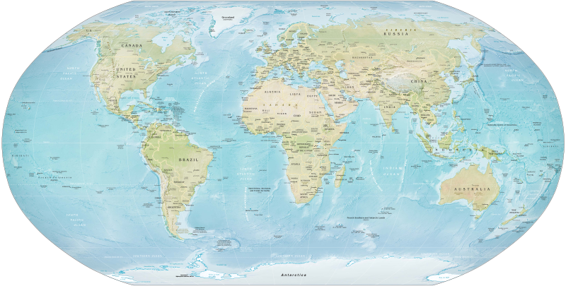
Physical map of Earth with political borders as of 2016
Geography (from Greek: γεωγραφία, geographia, literally "earth description")[1] is a field of science devoted to the study of the lands, features, inhabitants, and phenomena of the Earth and planets.[2] The first person to use the word γεωγραφία was Eratosthenes (276–194 BC).[3] Geography is an all-encompassing discipline that seeks an understanding of Earth and its human and natural complexities—not merely where objects are, but also how they have changed and come to be.
Geography is often defined in terms of two branches: human geography and physical geography.[4][5] Human geography deals with the study of people and their communities, cultures, economies, and interactions with the environment by studying their relations with and across space and place.[6] Physical geography deals with the study of processes and patterns in the natural environment like the atmosphere, hydrosphere, biosphere, and geosphere.
The four historical traditions in geographical research are: spatial analyses of natural and the human phenomena, area studies of places and regions, studies of human-land relationships, and the Earth sciences.[7] Geography has been called "the world discipline"[8] and "the bridge between the human and the physical sciences".[9]
Introduction[]
Geography is a systematic study of the Universe and its features. Traditionally, geography has been associated with cartography and place names. Although many geographers are trained in toponymy and cartology, this is not their main preoccupation. Geographers study the space and the temporal database distribution of phenomena, processes, and features as well as the interaction of humans and their environment.[10] Because space and place affect a variety of topics, such as economics, health, climate, plants and animals, geography is highly interdisciplinary. The interdisciplinary nature of the geographical approach depends on an attentiveness to the relationship between physical and human phenomena and its spatial patterns.[11]
Names of places...are not geography...know by heart a whole gazetteer full of them would not, in itself, constitute anyone a geographer. Geography has higher aims than this: it seeks to classify phenomena (alike of the natural and of the political world, in so far as it treats of the latter), to compare, to generalize, to ascend from effects to causes, and, in doing so, to trace out the laws of nature and to mark their influences upon man. This is 'a description of the world'—that is Geography. In a word Geography is a Science—a thing not of mere names but of argument and reason, of cause and effect.[12]—William Hughes, 1863
Just as all phenomena exist in time and thus have a history, they also exist in space and have a geography.[13]—United States National Research Council, 1997
Geography as a discipline can be split broadly into two main subsidiary fields: human geography and physical geography. The former largely focuses on the built environment and how humans create, view, manage, and influence space. The latter examines the natural environment, and how organisms, climate, soil, water, and landforms produce and interact.[14] The difference between these approaches led to a third field, environmental geography, which combines physical and human geography and concerns the interactions between the environment and humans.[10]
Branches[]
Physical geography[]
Physical geography (or physiography) focuses on geography as an Earth science. It aims to understand the physical problems and the issues of lithosphere, hydrosphere, atmosphere, pedosphere, and global flora and fauna patterns (biosphere). Physical Geography is the study of earth's seasons,climate ,atmosphere,soil, streams, landforms, and oceans.
")
Human geography[]
Human geography is a branch of geography that focuses on the study of patterns and processes that shape the human society. It encompasses the human, political, cultural, social, and economic aspects.
Various approaches to the study of human geography have also arisen through time and include:
- Behavioral geography
- Feminist geography
- Culture theory
- Geosophy
Integrated geography[]
Integrated geography is concerned with the description of the spatial interactions between humans and the natural world. It requires an understanding of the traditional aspects of physical and human geography, as well as the ways that human societies conceptualize the environment. Integrated geography has emerged as a bridge between human and physical geography, as a result of the increasing specialisation of the two sub-fields. Furthermore, as the human relationship with the environment has changed as a result of globalization and technological change, a new approach was needed to understand the changing and dynamic relationship. Examples of areas of research in environmental geography include: emergency management, environmental management, sustainability, and political ecology.
Geomatics[]
Digital Elevation Model (DEM)
Geomatics is concerned with the application of computers to the traditional spatial techniques used in cartography and topography. Geomatics emerged from the quantitative revolution in geography in the mid-1950s. Today, geomatics methods include spatial analysis, geographic information systems (GIS), remote sensing, and global positioning systems (GPS). Geomatics has led to a revitalization of some geography departments, especially in Northern America where the subject had a declining status during the 1950s.
Regional geography[]
Regional geography is concerned with the description of the unique characteristics of a particular region such as its natural or human elements. The main aim is to understand, or define the uniqueness, or character of a particular region that consists of natural as well as human elements. Attention is paid also to regionalization, which covers the proper techniques of space delimitation into regions.
Related fields[]
- Urban planning, regional planning, and spatial planning: Use the science of geography to assist in determining how to develop (or not develop) the land to meet particular criteria, such as safety, beauty, economic opportunities, the preservation of the built or natural heritage, and so on. The planning of towns, cities, and rural areas may be seen as applied geography.
- Regional science: In the 1950s, the regional science movement led by Walter Isard arose to provide a more quantitative and analytical base to geographical questions, in contrast to the descriptive tendencies of traditional geography programs. Regional science comprises the body of knowledge in which the spatial dimension plays a fundamental role, such as regional economics, resource management, location theory, urban and regional planning, transport and communication, human geography, population distribution, landscape ecology, and environmental quality.
- Interplanetary Sciences: While the discipline of geography is normally concerned with the Earth, the term can also be informally used to describe the study of other worlds, such as the planets of the Solar System and even beyond. The study of systems larger than the Earth itself usually forms part of Astronomy or Cosmology. The study of other planets is usually called planetary science. Alternative terms such as areology (the study of Mars) have been proposed but are not widely used.
Techniques[]
As spatial interrelationships are key to this synoptic science, maps are a key tool. Classical cartography has been joined by a more modern approach to geographical analysis, computer-based geographic information systems (GIS).
In their study, geographers use four interrelated approaches:
- Systematic – Groups geographical knowledge into categories that can be explored globally.
- Regional – Examines systematic relationships between categories for a specific region or location on the planet.
- Descriptive – Simply specifies the locations of features and populations.
- Analytical – Asks why we find features and populations in a specific geographic area.
Cartography[]
James Cook's 1770 chart of New Zealand
Cartography studies the representation of the Earth's surface with abstract symbols (map making). Although other subdisciplines of geography rely on maps for presenting their analyses, the actual making of maps is abstract enough to be regarded separately. Cartography has grown from a collection of drafting techniques into an actual science.
Cartographers must learn cognitive psychology and ergonomics to understand which symbols convey information about the Earth most effectively, and behavioural psychology to induce the readers of their maps to act on the information. They must learn geodesy and fairly advanced mathematics to understand how the shape of the Earth affects the distortion of map symbols projected onto a flat surface for viewing. It can be said, without much controversy, that cartography is the seed from which the larger field of geography grew. Most geographers will cite a childhood fascination with maps as an early sign they would end up in the field.
Geographic information systems[]
Geographic information systems (GIS) deal with the storage of information about the Earth for automatic retrieval by a computer, in an accurate manner appropriate to the information's purpose. In addition to all of the other subdisciplines of geography, GIS specialists must understand computer science and database systems. GIS has revolutionized the field of cartography: nearly all mapmaking is now done with the assistance of some form of GIS software. GIS also refers to the science of using GIS software and GIS techniques to represent, analyse, and predict the spatial relationships. In this context, GIS stands for geographic information science.
Remote sensing[]
Remote sensing is the science of obtaining information about Earth features from measurements made at a distance. Remotely sensed data comes in many forms, such as satellite imagery, aerial photography, and data obtained from hand-held sensors. Geographers increasingly use remotely sensed data to obtain information about the Earth's land surface, ocean, and atmosphere, because it: (a) supplies objective information at a variety of spatial scales (local to global), (b) provides a synoptic view of the area of interest, (c) allows access to distant and inaccessible sites, (d) provides spectral information outside the visible portion of the electromagnetic spectrum, and (e) facilitates studies of how features/areas change over time. Remotely sensed data may be analysed either independently of, or in conjunction with other digital data layers (e.g., in a geographic information system).
Quantitative methods[]
Geostatistics deal with quantitative data analysis, specifically the application of statistical methodology to the exploration of geographic phenomena. Geostatistics is used extensively in a variety of fields, including hydrology, geology, petroleum exploration, weather analysis, urban planning, logistics, and epidemiology. The mathematical basis for geostatistics derives from cluster analysis, linear discriminant analysis and non-parametric statistical tests, and a variety of other subjects. Applications of geostatistics rely heavily on geographic information systems, particularly for the interpolation (estimate) of unmeasured points. Geographers are making notable contributions to the method of quantitative techniques.
Qualitative methods[]
Geographic qualitative methods, or ethnographical research techniques, are used by human geographers. In cultural geography there is a tradition of employing qualitative research techniques, also used in anthropology and sociology. Participant observation and in-depth interviews provide human geographers with qualitative data.
History[]
The oldest known world maps date back to ancient Babylon from the 9th century BC.[15] The best known Babylonian world map, however, is the Imago Mundi of 600 BC.[16] The map as reconstructed by Eckhard Unger shows Babylon on the Euphrates, surrounded by a circular landmass showing Assyria, Urartu[17] and several cities, in turn surrounded by a "bitter river" (Oceanus), with seven islands arranged around it so as to form a seven-pointed star. The accompanying text mentions seven outer regions beyond the encircling ocean. The descriptions of five of them have survived.[18] In contrast to the Imago Mundi, an earlier Babylonian world map dating back to the 9th century BC depicted Babylon as being further north from the center of the world, though it is not certain what that center was supposed to represent.[15]
The ideas of Anaximander (c. 610–545 BC): considered by later Greek writers to be the true founder of geography, come to us through fragments quoted by his successors. Anaximander is credited with the invention of the gnomon, the simple, yet efficient Greek instrument that allowed the early measurement of latitude. Thales is also credited with the prediction of eclipses. The foundations of geography can be traced to the ancient cultures, such as the ancient, medieval, and early modern Chinese. The Greeks, who were the first to explore geography as both art and science, achieved this through Cartography, Philosophy, and Literature, or through Mathematics. There is some debate about who was the first person to assert that the Earth is spherical in shape, with the credit going either to Parmenides or Pythagoras. Anaxagoras was able to demonstrate that the profile of the Earth was circular by explaining eclipses. However, he still believed that the Earth was a flat disk, as did many of his contemporaries. One of the first estimates of the radius of the Earth was made by Eratosthenes.[19]
The first rigorous system of latitude and longitude lines is credited to Hipparchus. He employed a sexagesimal system that was derived from Babylonian mathematics. The meridians were sub-divided into 360°, with each degree further subdivided into 60 (minutes). To measure the longitude at different locations on Earth, he suggested using eclipses to determine the relative difference in time.[20] The extensive mapping by the Romans as they explored new lands would later provide a high level of information for Ptolemy to construct detailed atlases. He extended the work of Hipparchus, using a grid system on his maps and adopting a length of 56.5 miles for a degree.[21]
From the 3rd century onwards, Chinese methods of geographical study and writing of geographical literature became much more comprehensive than what was found in Europe at the time (until the 13th century).[22] Chinese geographers such as Liu An, Pei Xiu, Jia Dan, Shen Kuo, Fan Chengda, Zhou Daguan, and Xu Xiake wrote important treatises, yet by the 17th century advanced ideas and methods of Western-style geography were adopted in China.
The Ptolemy world map, reconstituted from Ptolemy's Geographia, written c. 150
During the Middle Ages, the fall of the Roman empire led to a shift in the evolution of geography from Europe to the Islamic world.[22] Muslim geographers such as Muhammad al-Idrisi produced detailed world maps (such as Tabula Rogeriana), while other geographers such as Yaqut al-Hamawi, Abu Rayhan Biruni, Ibn Battuta, and Ibn Khaldun provided detailed accounts of their journeys and the geography of the regions they visited. Turkish geographer, Mahmud al-Kashgari drew a world map on a linguistic basis, and later so did Piri Reis (Piri Reis map). Further, Islamic scholars translated and interpreted the earlier works of the Romans and the Greeks and established the House of Wisdom in Baghdad for this purpose.[23] Abū Zayd al-Balkhī, originally from Balkh, founded the "Balkhī school" of terrestrial mapping in Baghdad.[24] Suhrāb, a late tenth century Muslim geographer accompanied a book of geographical coordinates, with instructions for making a rectangular world map with equirectangular projection or cylindrical equidistant projection.[24]Template:Verify source
Abu Rayhan Biruni (976–1048) first described a polar equi-azimuthal equidistant projection of the celestial sphere.[25] He was regarded as the most skilled when it came to mapping cities and measuring the distances between them, which he did for many cities in the Middle East and the Indian subcontinent. He often combined astronomical readings and mathematical equations, in order to develop methods of pin-pointing locations by recording degrees of latitude and longitude. He also developed similar techniques when it came to measuring the heights of mountains, depths of the valleys, and expanse of the horizon. He also discussed human geography and the planetary habitability of the Earth. He also calculated the latitude of Kath, Khwarezm, using the maximum altitude of the Sun, and solved a complex geodesic equation in order to accurately compute the Earth's circumference, which was close to modern values of the Earth's circumference.[26] His estimate of 6,339.9 km for the Earth radius was only 16.8 km less than the modern value of 6,356.7 km. In contrast to his predecessors, who measured the Earth's circumference by sighting the Sun simultaneously from two different locations, al-Biruni developed a new method of using trigonometric calculations, based on the angle between a plain and mountain top, which yielded more accurate measurements of the Earth's circumference, and made it possible for it to be measured by a single person from a single location.[27]
Self portrait of Alexander von Humboldt, one of the early pioneers of geography as an academic subject in modern sense
The European Age of Discovery during the 16th and the 17th centuries, where many new lands were discovered and accounts by European explorers such as Christopher Columbus, Marco Polo, and James Cook revived a desire for both accurate geographic detail, and more solid theoretical foundations in Europe. The problem facing both explorers and geographers was finding the latitude and longitude of a geographic location. The problem of latitude was solved long ago but that of longitude remained; agreeing on what zero meridian should be was only part of the problem. It was left to John Harrison to solve it by inventing the chronometer H-4 in 1760, and later in 1884 for the International Meridian Conference to adopt by convention the Greenwich meridian as zero meridian.[28]
The 18th and the 19th centuries were the times when geography became recognized as a discrete academic discipline, and became part of a typical university curriculum in Europe (especially Paris and Berlin). The development of many geographic societies also occurred during the 19th century, with the foundations of the Société de Géographie in 1821,[29] the Royal Geographical Society in 1830,[30] Russian Geographical Society in 1845,[31] American Geographical Society in 1851,[32] and the National Geographic Society in 1888.[33] The influence of Immanuel Kant, Alexander von Humboldt, Carl Ritter, and Paul Vidal de la Blache can be seen as a major turning point in geography from a philosophy to an academic subject.
Over the past two centuries, the advancements in technology with computers have led to the development of geomatics and new practices such as participant observation and geostatistics being incorporated into geography's portfolio of tools. In the West during the 20th century, the discipline of geography went through four major phases: environmental determinism, regional geography, the quantitative revolution, and critical geography. The strong interdisciplinary links between geography and the sciences of geology and botany, as well as economics, sociology and demographics have also grown greatly, especially as a result of earth system science that seeks to understand the world in a holistic view.
Notable geographers[]
Gerardus Mercator
- Eratosthenes (276–194 BC) – calculated the size of the Earth.
- Strabo (64/63 BC – c. AD 24) – wrote Geographica, one of the first books outlining the study of geography.
- Ptolemy (c. 90–168) – compiled Greek and Roman knowledge into the book Geographia.
- Al Idrisi (Arabic: أبو عبد الله محمد الإدريسي; Latin: Dreses) (1100–1165/66) – author of Nuzhatul Mushtaq.
- Gerardus Mercator (1512–1594) – innovative cartographer produced the mercator projection
- Alexander von Humboldt (1769–1859) – considered father of modern geography, published Cosmos and founder of the sub-field biogeography.
- Carl Ritter (1779–1859) – considered father of modern geography, occupied the first chair of geography at Berlin University.
- Arnold Henry Guyot (1807–1884) – noted the structure of glaciers and advanced understanding in glacier motion, especially in fast ice flow.
- Radhanath Sikdar (1813–1870) – calculated the height of Mount Everest.
- William Morris Davis (1850–1934) – father of American geography and developer of the cycle of erosion.
- Paul Vidal de la Blache (1845–1918) – founder of the French school of geopolitics, wrote the principles of human geography.
- John Francon Williams (1854–1911) - noted author of The Geography of the Oceans and other geography works.
- Sir Halford Mackinder (1861–1947) – co-founder of the LSE, Geographical Association.
- Ellen Churchill Semple (1863–1932) – first influential female geographer in the United States.
- Carl O. Sauer (1889–1975) – prominent cultural geographer.
- Walter Christaller (1893–1969) – human geographer and inventor of Central place theory.
- Yi-Fu Tuan (born 1930) – Chinese-American scholar credited with starting Humanistic Geography as a discipline.
- Karl W. Butzer (1934–2016) – influential German-American geographer, cultural ecologist and environmental archaeologist.
- David Harvey (born 1935) – Marxist geographer and author of theories on spatial and urban geography, winner of the Vautrin Lud Prize.
- Edward Soja (1941–2015) – noted for his work on regional development, planning and governance along with coining the terms Synekism and Postmetropolis; winner of the Vautrin Lud Prize.
- Michael Frank Goodchild (born 1944) – prominent GIS scholar and winner of the RGS founder's medal in 2003.
- Doreen Massey (1944–2016) – key scholar in the space and places of globalization and its pluralities; winner of the Vautrin Lud Prize.
- Nigel Thrift (born 1949) – originator of non-representational theory.
- [Ernest Burgess] : Concentric Zone Model
Institutions and societies[]
- American Geographical Society (US)
- Anton Melik Geographical Institute (Slovenia)
- American Association of Geographers (AAG)
- Institute of Geographical Information Systems (Pakistan)
- Karachi Geographical Society (Pakistan)
- National Geographic Society (US)
- Royal Canadian Geographical Society (Canada)
- Royal Geographical Society (UK)
- Russian Geographical Society (Russia)
- Royal Danish Geographical Society (Denmark)
Publications[]
- African Geographical Review
- Geographical Review
References[]
- ↑ Harper, Douglas. "Online Etymology Dictionary". Etymonline.com. Online Etymology Dictionary. Archived from the original on 12 February 2009. Retrieved 10 November 2016.<templatestyles src="Module:Citation/CS1/styles.css"></templatestyles>
- ↑ "Geography". The American Heritage Dictionary/ of the English Language, Fourth Edition. Houghton Mifflin Company. Archived from the original on 9 November 2006. Retrieved 9 October 2006.<templatestyles src="Module:Citation/CS1/styles.css"></templatestyles>
- ↑ Eratosthenes (2010-01-24). Eratosthenes' Geography. Princeton University Press. ISBN 978-0-691-14267-8. https://books.google.com/books/about/Eratosthenes_Geography.html?id=8peKyWK_SWsC. Retrieved 2015-06-26.
- ↑ Pidwirny, Dr. Michael; Jones, Scott. "Chapter 1: Introduction to Physical Geography". Physicalgeography.net. University of British Columbia Okanagan. Archived from the original on 1 May 2009. Retrieved 10 November 2016.<templatestyles src="Module:Citation/CS1/styles.css"></templatestyles>
- ↑ Bonnett, Alastair (2008). What is Geography?. SAGE Publications. ISBN 978-1-84920-649-5. https://books.google.com/books/about/What_is_Geography.html?id=G_491U8PQFEC. Retrieved 10 November 2016.
- ↑ Johnston, Ron (2000). "Human Geography". In Johnston, Ron; Gregory, Derek; Pratt, Geraldine; et al. (eds.). The Dictionary of Human Geography. Oxford: Blackwell. pp. 353–360.<templatestyles src="Module:Citation/CS1/styles.css"></templatestyles>
- ↑ Pattison, William D. (Summer 1990). "The Four Traditions of Geography". Journal of Geography September/October 1990 (5): 202–206. 1964. doi:10.1080/00221349008979196. ISSN 0022-1341. http://www.geog.ucsb.edu/~kclarke/G200B/four_20traditions_20of_20geography.pdf. Retrieved 10 November 2016.
- ↑ Bonnett, Alastair (March 2003). "Geography as the world discipline: connecting popular and academic geographical imaginations" (in en). Area 35 (1): 55–63. doi:10.1111/1475-4762.00110. ISSN 0004-0894.
- ↑ Dorn, Harold (1991) (in en). The Geography of Science. Johns Hopkins University Press. ISBN 978-0-8018-4151-4. https://books.google.com/?id=9q3aAAAAMAAJ&q=The+geography+of+science&dq=The+geography+of+science.
- ↑ 10.0 10.1 Hayes-Bohanan, James (29 September 2009). "What is Environmental Geography, Anyway?". webhost.bridgew.edu. Bridgewater State University. Archived from the original on 26 October 2006. Retrieved 10 November 2016.<templatestyles src="Module:Citation/CS1/styles.css"></templatestyles>
- ↑ Hornby, William F.; Jones, Melvyn (1991-06-28). An introduction to Settlement Geography. Cambridge University Press (published 29 June 1991). ISBN 978-0-521-28263-5. https://books.google.com/books/about/An_Introduction_to_Settlement_Geography.html?id=DLpzQgAACAAJ. Retrieved 10 November 2016.
- ↑ Hughes, William. (1863). The Study of Geography. Lecture delivered at King's College, London by Sir Marc Alexander. Quoted in Baker, J.N.L (1963). The History of Geography. Oxford: Basil Blackwell. pp. 66. ISBN 978-0-85328-022-4.
- ↑ "Chapter 3: Geography's Perspectives". Rediscovering Geography: New Relevance for Science and Society. Washington, DC: The National Academies Press. 1997. pp. 28. http://www.nap.edu/openbook.php?record_id=4913&page=28. Retrieved 2014-05-06.
- ↑ "What is geography?". AAG Career Guide: Jobs in Geography and related Geographical Sciences. American Association of Geographers. Archived from the original on October 6, 2006. Retrieved October 9, 2006.<templatestyles src="Module:Citation/CS1/styles.css"></templatestyles>
- ↑ 15.0 15.1 Kurt A. Raaflaub & Richard J.A. Talbert (2009). Geography and Ethnography: Perceptions of the World in Pre-Modern Societies. John Wiley & Sons. p. 147. ISBN 978-1-4051-9146-3
- ↑ Siebold, Jim. "Slide 103". henry-davis.com. Henry Davis Consulting Inc. Archived from the original on 9 November 2016. Retrieved 10 November 2016.<templatestyles src="Module:Citation/CS1/styles.css"></templatestyles>
- ↑ Delano Smith, Catherine (1996). "Imago Mundi's Logo the Babylonian Map of the World". Imago Mundi 48: 209–211. doi:10.1080/03085699608592846. JSTOR 1151277.
- ↑ Finkel, Irving (Winter 1995). A join to the map of the world: A notable discovery. British Museum Magazine. pp. 26–27. ISBN 978-0-7141-2073-7.
- ↑ Tassoul, Jean-Louis; Tassoul, Monique (2004). A Concise History of Solar and Stellar Physics. London: Princeton University Press. ISBN 978-0-691-11711-9. https://books.google.com/books/about/A_Concise_History_of_Solar_and_Stellar_P.html?id=nRtUait0qTgC. Retrieved 10 November 2016.
- ↑ "Hipparchus of Rhodes". tmth.edu.gr. Thessaloniki Science Center and Technology Museum. 2001. Archived from the original on 20 July 2008. Retrieved 10 November 2016.<templatestyles src="Module:Citation/CS1/styles.css"></templatestyles>
- ↑ Sullivan, Dan (2000). "Mapmaking and its History". Rutgers University. Archived from the original on 4 March 2016. Retrieved 10 November 2016.<templatestyles src="Module:Citation/CS1/styles.css"></templatestyles>
- ↑ 22.0 22.1 Needham, Joseph (1959). Mathematics and the Sciences of the Heavens and the Earth. 3. Taipei: Caves Books, Ltd.. p. 512. ISBN 978-0-521-05801-8. https://books.google.com/books/about/Science_and_Civilisation_in_China_Volume.html?id=jfQ9E0u4pLAC. Retrieved 10 November 2016.
- ↑ "Science and Scholarship in Al-Andalus". IslamiCity.com. IslamiCity. Archived from the original on 17 June 2016. Retrieved 10 November 2016.<templatestyles src="Module:Citation/CS1/styles.css"></templatestyles>
- ↑ 24.0 24.1 Edson, Evelyn; Savage-Smith, Emilie (Winter 2007). "Medieval Views of the Cosmos". International Journal of the Classical Tradition 13:3 (3): 61–63. JSTOR 30222166.
- ↑ King, David A. (1996). Rashed, Roshdi. ed. Astronomy and Islamic society: Qibla, gnomics and timekeeping. 1. pp. 128–184. ISBN 978-0-203-71184-2. http://qisar.fssr.uns.ac.id/wp-content/uploads/2015/04/Qisar-Roshdi-Rashed-Encyclopedia-of-the-History-of-Arabic-Science.pdf. Retrieved 10 November 2016.
- ↑ Aber, James Sandusky (2003). "Abu Rayhan al-Biruni". academic.emporia.edu. Emporia State University. Archived from the original on 11 August 2011. Retrieved 10 November 2016.<templatestyles src="Module:Citation/CS1/styles.css"></templatestyles>
- ↑ Goodman, Lenn Evan (1992). Avicenna. Great Britain: Routledge. pp. 31. ISBN 978-0-415-01929-3. https://books.google.com/?id=VJ6x-pcqMicC&pg=PA109&q=biruni. Retrieved 10 November 2016. "It was Biruni, not Avicenna, who found a way for a single man, at a single moment, to measure the earth's circumference, by trigonometric calculations based on angles measured from a mountaintop and the plain beneath it – thus improving on Eratosthenes' method of sighting the sun simultaneously from two different sites, applied in the ninth century by astronomers of the Khalif al-Ma'mun."
- ↑ Aughton, Peter (2009). Voyages that changed the world. Penguin Group. p. 164. ISBN 978-1-84724-004-0. https://books.google.com/?id=bz4GyOioMF4C&pg=RA1-PA164#v=onepage. Retrieved 10 November 2016.
- ↑ "Société de Géographie, Paris, France". socgeo.org (in French). Société de Géographie. Archived from the original on 6 November 2016. Retrieved 10 November 2016.<templatestyles src="Module:Citation/CS1/styles.css"></templatestyles>
- ↑ "About Us". rgs.org. Royal Geographical Society. Archived from the original on 18 October 2016. Retrieved 10 November 2016.<templatestyles src="Module:Citation/CS1/styles.css"></templatestyles>
- ↑ "Русское Географическое Общество (основано в 1845 г.)". rgo.org.ru (in Russian). Russian Geological Society. Archived from the original on 2012-05-24. Retrieved 10 November 2016.<templatestyles src="Module:Citation/CS1/styles.css"></templatestyles>
- ↑ "History". Amergeog.org. The American Geographical Society. Archived from the original on 2016-10-17. Retrieved 10 November 2016.<templatestyles src="Module:Citation/CS1/styles.css"></templatestyles>
- ↑ "National Geographic Society". state.gov. U.S. Department of State. Retrieved 10 November 2016.<templatestyles src="Module:Citation/CS1/styles.css"></templatestyles>
Template:Geography topics
Template:Glossaries of science and engineering
www. nationalgeographic.org